In recent years, Hawaii has become my most popular holiday destination. The climate with the warm trade wind is very pleasant and the water of the Pacific is beyond clear.On the islands I know myself now quite good and have a lot of useful tips for those interested.
If you mention the word in Germany, Hawaii, many believe a single island in the South Pacific in front of him, full of hula girls under green palm tree tops, and on which there is no beer. In reality it is more than a hundred uninhabited atolls, and eight large islands, have the American standard and among the most popular tourist destinations in the world. They are visited each week by about 180 000 tourists. Since almost all arrive by plane, some 100 jets land at the airports of Honolulu, Kahului, Kona, Hilo and Lihue. They are used to estimate roughly what a huge flood of tourists every day Hawaii. Nevertheless, all laid out very quickly and turns itself on arrival in Honolulu in a leisurely driving, where everything is strange hectic.
A friendly "Aloha"sounds contrary to all strangers who arrive at a fragrant flower wreath - the "Lei" - is put down as a greeting. A warm wind envelops all in the open halls of the airports and raises in the visitors carefree holiday atmosphere. Such a feeling can be found only in Tahiti and Fiji.Since Honolulu is the first stop for most tourists, I would like to begin my travel tips is available with it.Honolulu is the capital of the State of Hawaii, is located on the island of O'ahu and has 400 000 inhabitants. The 800 000 inhabitants of this island are already 75% of the total population of all islands together. The cause is the reason for the traffic problems and the stress that all major cities.
A note on pronunciation of the Hawaiian name:
The name of the U.S. government is not Hawaii, but Hawaii - he not only has two "i ", but the last letter is a little break and made the "i" pronounced separately. This is related to the original name and the pronunciation have officially set the Hawaiians. Since most tourists and Americans do not know, you see why many names an apostrophe at the point where a break between the letters to be made. This is also in the other islands O'ahu, Kaua'i, Moloka'i, Lana'i and Ni'ihau is the case, not only in Maui. The island itself is called Big Hawai'i Iceland because the whole country was given the name Hawaii. However, the name on the Internet and computer entries are often written together. Therefore, you will find on my website different spellings.
But all is forgotten when you arrive after 20 minutes on the highway in Waikiki. Although it is a lot going on here, but it already has a special appeal, in the evening at the Royal Hawaiian to drink a Mai Tai and watching the sunset. In addition, the Beach Boys, surfers and boogie boarders are watching this very active and it's great fun to them.
It's just a totally different world here in the morning stroll on the beach, afternoons on the International Market and stroll in the evening to experience the pulsating life Kalakaua Ave Waikiki. For many it will seem very strange that many Japanese are here, and that many shops have stopped completely out - not only because they are even in Japanese hands ...
It is certainly a little corny, but beautiful: the Kodak Hula Show at Kapiolani Park will find you on Tuesdays, Wednesdays and Thursdays at 10:00 clock. Go and enjoy the show. Although it has been taken over by another company, but still the best hula dancers from all over Hawaii. The only equivalent is non-commercial show it only in the Bishop Museum, and there you will encounter the same hula dancers.
O'ahu is a very beautiful island that has many attractions and sites, if one is only a few miles from Honolulu or Waikiki out. You should really go to Sandy Beach and surf in the meter-high waves. That goes with the long board, the board that the boogie board or without board with the body. It's great. Borrow from a surfboard in Waikiki and try it! If you are here in the winter months, you should not miss to visit Sunset Beach escape. But the watching is breathtaking, if the surfers glide elegantly through the 6m high waves. A rollover on these waves corresponds to a fall from.
Beaches in Hawaii
All beaches in Hawaii are public - even those that lie in front of hotels or private houses. There is a state rule that says that the beach in the width of the highest winter tide be publicly available to everybody and can not be bought. The hotels must provide a separate access to the beach for other guests. Keep always on the lookout for the signs "Beach Access " or "Shoreline Access". This scheme is wonderful, because then one has ever showers and toilets. They do exist but also in the beach parks that are everywhere on the islands. This, of course, picnic benches, grills and parking, as the indigenous Hawaiians love nothing more than a picnic on the weekend in the Beach Park with family friends. Very pleasant is the fact that the waste is disposed of every day and the toilets are cleaned.
On the following pages I have listed for each island's finest beaches. Of course it depends on what you want to do there: swimming, snorkeling, diving, surfing, walking, jogging ... Each beach has its own particular merits. For more information, visit Dr. Beach, which is the nickname of Professor Dr. Stephen Leatherman, which each year publishes a list of the best beaches in America. Almost always a beach in Hawaii is number one. In 2006 it was the Fleming Beach on Maui. Almost all Visitor magazines also contain a list of beaches and their particular advantages.
Honolulu is inextricably linked to Pearl Harbor and the Pacific War. Very interesting history lessons you will experience when you visit the Arizona Memorial.
The not to be missed. Take necessarily early in the morning there, because the trips are limited. Because the groups are divided, you will otherwise have to wait long. However, it is not so bad, because this time you can visit the impressive exhibition. A film about visiting the Pearl Harbor attack, is mandatory. Then you will be taken by the rangers by boat to the ship wreck.
Driving in Hawaii:
Since it in the Hawaiian Islands no public transport there (with the exception of some bus routes in Honolulu), the entire motor traffic handled. Everyone has a car and wants it best to the front door of his chosen target. Rental cars are extremely cheap. I e.g. In October 2010 the cars for each of the islands from Germany booked and paid in dollars for an economy or compact car per day $ 24.40. That included all insurance and taxes. The end result I then always have a higher class car for same price, because the small classes were not available. You can even have cheaper if you use the insurance of your credit card, however, is then usually the amount of loss is limited to a relatively low amount.
Restaurants in Hawaii:
Of course there are all types of Hawaii American fast-food chains and steakhouses. In addition, the islands offer but something very special: the "Pacific Rim Cuisine" or "Hawaiian Fusion". If you value good food, you should visit this restaurant offering a typical Hawaiian cuisine or Pacific Rim cuisine. A few years ago there was the famous "Pacific Cafe" on the islands. Now there is only one in Las Vegas. Too bad. Let yourself be fooled by the way, the term "café". In Polynesia, the restaurants are called very often like that.
Because I personally am a fan of this kitchen, I have to "Pacific Rim Cuisine" created a separate web page where you will find all the information on this and the various restaurants on the islands.
Golf courses in Hawaii:
Hawaii certainly has some of the most beautiful golf courses all over the world. I'm not a golfer, but often live on the golf courses, often because there are cottages, which have a great location and rent at a reasonable price. The islands are trying to offer each other in the Gulf to excel. Among the more than 100 people by the avid golfer everything their hearts desire. The rent is very different. In public places you can certainly play for $ 18-40, while it costs the clubs usually $ 75-100, also because most places are better. The high-quality places you have to shell out more than $ 100. Who does not want to inform the appropriate golf magazines can visit the websites below.
Prices in Hawaii
Like all U.S. states, including Hawaii has its own characteristics. It starts with the tax that amounts to 12.4% (2010). On all hotel and Condopreise have to expect that amount on it, in principle, to all but the tax rates of 4.166%. All price tags you see in stores are net prices. Therefore, you have the spirit to all the tax rates of 4.166% added to it. This is also the case in the supermarket. Here of course the fruit range is fantastic, the prices are unfortunately too. It is incomprehensible to us German that a pineapple that grows here, 1.99 $ / lb cost, which usually means 6 $ for the piece, while here in Germany, despite the high freight costs from Hawaii from 1,99 $ each is to have. The same price difference can be found in all fruits. Fruit is therefore an expensive in Hawaii.
The Hawaiians are smart and buy directly from farmers or at the Farmer's Markets, where they pay only a fraction of everything. I have also tried several times and was always immediately identified as a tourist to pay the other prizes kindly added. You can work around the problem really only when you have a Hawaiian friend who goes shopping for one. Who has a Hawaiian identity, moreover, also gets very different prices at the airlines for the Iceland international flights, or for any events. These are the so-called "kama'aina" - price.
A baguette at the supermarket costs $ 2.19 a quarter pound of roast turkey $ 2.50, a quarter pound black forest ham $ 2.60 and $ 1.90 a quarter pound of cheese. The prices for milk, butter and kitchen items are similar to ours. Meat is much cheaper, more expensive fish (totally incomprehensible!). European cheeses are naturally quite expensive.
Thursday, March 31, 2011
Yosemite National Park
Yosemite National Park is certainly a superlative and possibly surpassed by the Grand Canyon. The sight of the thundering waterfalls, the magnificent towering granite walls almost perpendicular to raise some polished rocks Dome and the giant sequoias even the most exhausted travelers again. This stunning and unique landscape makes the Yosemite National Park is one of the most beautiful places in California.
Yosemite as a testimony to the immense forces of nature
Yosemite National Park is one of the world's best-known example of a milled through U-shaped glacial valley (formed by rivers, valleys have a V-shape). Some millions of years was in the valley of a river that eroded over time an up to 650 m deep canyon. During an ice age filled up the canyon to its edge with water and possibly one or more glaciers. They extended the canyon at its weakest points and deepened the Yosemite Valley. After the ice age of the bottom of the valley from a lake was covered. The muddy lake during the ice age and became today's lush meadows, which is equipped with pine trees and huge granite peaks.
On 25 March 1851 White first came to the Yosemite Valley, which was inhabited until that time by Indians. The reports of these first visitors quickly aroused the interest of the population. In 1864 was signed by President Lincoln the Yosemite transfer, the state of California undertook to preserve the Yosemite Valley and the Mariposa Grove in its natural beauty. 1890 Yosemite National Park and was named to the second national park in the U.S. - after Yellowstone National Park.
Yosemite National Park has an area of 3,000 km2. It covers one of the richest forests and aquatic portions of the Sierra Nevada. The significant differences in height of Yosemite National Park (from 400 to 4,000 m) offer many different plant and animal species, excellent living conditions. Thus deer, black bears, coyotes and numerous rodents in the lower regions of their home. Several groves of massive giant sequoia trees, especially in the Mariposa Grove, are among the special attractions of Yosemite National Park.
Getting to Yosemite National Park
Yosemite National Park is easily accessible from Highway 120 that runs through the entire National Park in east-west direction to reach from the east of Lee Vining. However, the Highway 120 is usually closed from October to May From the West can be reached by highway 41 (about Fresno and Oakhurst), 120 and 140 of Monteco easily over Merced in Yosemite National Park.
The inputs of Yosemite National Park, Big Oak Flat (Highway 120), Arch Rock (Highway 140) and the South Entrance (Highway 41), the visitor will receive after payment of the entry ($ 20 and is valid for 7 days) a very good card of Yosemite National Park, with which you can easily plan your stay in the park. In July and August, the probability is quite high that the Yosemite National Park is full to overflowing. If you're unlucky, then even the Yosemite National Park closed. This can occur on summer weekends means.
 In the Visitor Center in Yosemite Valley or Tuolumne Meadows, is also very informative, and free "Yosemite Guide"is available. Yosemite National Park has a total of a network of 1,100 km of hiking trails, but there are also 325 km paved roads, so you can explore the Yosemite National Park is also a convenient way. Before you drive into the Yosemite National Park, make sure that you fill up in advance, as it is in Yosemite National Park are no gas stations and the distances within the Yosemite National Parks are great.
Yosemite as a testimony to the immense forces of nature
Yosemite National Park is one of the world's best-known example of a milled through U-shaped glacial valley (formed by rivers, valleys have a V-shape). Some millions of years was in the valley of a river that eroded over time an up to 650 m deep canyon. During an ice age filled up the canyon to its edge with water and possibly one or more glaciers. They extended the canyon at its weakest points and deepened the Yosemite Valley. After the ice age of the bottom of the valley from a lake was covered. The muddy lake during the ice age and became today's lush meadows, which is equipped with pine trees and huge granite peaks.
On 25 March 1851 White first came to the Yosemite Valley, which was inhabited until that time by Indians. The reports of these first visitors quickly aroused the interest of the population. In 1864 was signed by President Lincoln the Yosemite transfer, the state of California undertook to preserve the Yosemite Valley and the Mariposa Grove in its natural beauty. 1890 Yosemite National Park and was named to the second national park in the U.S. - after Yellowstone National Park.
Yosemite National Park has an area of 3,000 km2. It covers one of the richest forests and aquatic portions of the Sierra Nevada. The significant differences in height of Yosemite National Park (from 400 to 4,000 m) offer many different plant and animal species, excellent living conditions. Thus deer, black bears, coyotes and numerous rodents in the lower regions of their home. Several groves of massive giant sequoia trees, especially in the Mariposa Grove, are among the special attractions of Yosemite National Park.
Getting to Yosemite National Park
Yosemite National Park is easily accessible from Highway 120 that runs through the entire National Park in east-west direction to reach from the east of Lee Vining. However, the Highway 120 is usually closed from October to May From the West can be reached by highway 41 (about Fresno and Oakhurst), 120 and 140 of Monteco easily over Merced in Yosemite National Park.
The inputs of Yosemite National Park, Big Oak Flat (Highway 120), Arch Rock (Highway 140) and the South Entrance (Highway 41), the visitor will receive after payment of the entry ($ 20 and is valid for 7 days) a very good card of Yosemite National Park, with which you can easily plan your stay in the park. In July and August, the probability is quite high that the Yosemite National Park is full to overflowing. If you're unlucky, then even the Yosemite National Park closed. This can occur on summer weekends means.
Tuesday, March 29, 2011
Hong Kong - City Of Live
There are over most of the cities and countries, especially if they rise to regular tourist resorts. This page is created from a completely different reason and has little or nothing in common with conventional travel guides.
 The Hong Kong of today is so promising that few places in the world. Here it seems to have succeeded: the merging of East and West. Hong Kong is harmonious, but still busy and always on the move. The city has the highest population density, but one of the lowest crime rates in the world. To understand these contradictions, it is not enough to tick all the sights. You have to experience the unique atmosphere of the busy streets of the city and the mentality of the people.
I can not say exactly when my interest in Asia has been aroused, but I had to realize in hindsight that I was probably for a long time more complete information unconsciously have really sucked me in need. The only way to explain that I found both when reading guidebooks less and less new and on my first visit to Asia on average, according to the locals a lot about the country, the culture and the people knew.
3453 days before I met my girlfriend at the time know that from Hong Kong for 10 years lived in Germany. This contact in-depth knowledge and interest is necessarily always more. In each of our meeting, I wanted to find out the normal between friends to talk about "your" city and its "culture" and could dip any time in a strange world to me at first.
2003, it was time. I wanted to see it with my own eyes and experience what I had known only from television, books and stories .. I planned my first trip to Asia and did not want to join in the typical tourist tour. So I deepened my knowledge again in the hope of well-prepared in the "City of Live ", as it is called by the Hong Kong Tourist Authority itself to travel.
Completely overwhelmed, and added some completely overwhelmed me was the first day of my trip realized that I had to document this trip - did the idea for this site.
Victoria Falls in Zimbabwe
About 300 km northwest of Harare crashes the Zambezi, the Victoria Falls, at a latitude of almost 1,700 meters, up to 108 feet deep into a wide, only about 50 feet gorge. The locals call the falls "Mosi-oa-Tunya" which means "smoke that thunders".

In the rainy season around 10 million liters of water per second flowing over the edge. The resulting spray of the falls may rise to 400 meters in height, produces close to a lush jungle.
The waterfall, you should take in any case accompanied by rain, to be not completely soaked.
The Victoria case was on 16/11/1855 from the major British missionary and explorer David Livingstone, the first white men first reached and described. In honor of Queen Victoria, he named the falls after her.
If you are from the west, ie from Zimbabwe, Victoria Falls National Park and enter the same take the first left path, they encounter the Livingstone statue. From here you have a look at the deepest and richest part of the water falls.
The round trip on a small plane or a helicopter as we made clear the enormous impact of the water masses and the size of the falls. The flight takes about 20 minutes, but the 120 dollars it was worth.
Completed in 1905, a railway bridge, the line between Cape Town (South Africa) and Lubumbashi (Südzaire), spans the gorge below the falls in 130 meters height. Thanks to this rail link, the number of visitors to the Victoria Falls at the beginning of the 20th Century skyrocketing. Quickly emerged in Victoria Falls town small hotels and souvenir shops, from which there is still some.
the most beautiful dreams Maldives
Do you dream of swimming on deserted beaches, barefoot running, switch off and relax in paradise? A sand bank dinner, an unforgettable wedding ceremony, a jeep safari, sailing, diving and pure relaxation? Holiday dreams are the most beautiful dreams. And they are as unique as the people they dream of. For this reason, we create tailor-made for more than 20 years traveling in the paradises of the world, as individual as you and your dreams. Each of our journeys is unique, made ?with passion, love and by hand.
 Holidays in the Maldives
Holidays MaldivahSamoe surprising that celebrate the people who were on holiday in the Maldives that it looks absolutely as in reality, as in the photographs. The same unreal turquoise, blue lagoons, amazing white velvet beach, marine life imaginable colors and colorings and rich green verdure of the islands.
After seeing the gray city is unusual and exciting at the same time. "Picture" absorbs the mind and takes a vacation with his head, wiping the bustling everyday problems of everyday life. Complete relaxation, a complete shutdown, instant and total immersion in the rest.Begin to see, feel, hear and present the most important thing in life.Check it out - now the holiday in the Maldives became available to anyone who really wants something meaningful in their lives.
Who and why most choose things to do in Maldives?
1.Diving Maldivah1. Fans of romance "paradise islands", the newlyweds and couples seeking to breathe new life into the fading relationship.
2. Living in cities of all ages and social groups who are tired of monotony of everyday life, an array of unnecessary information and endless bustle of "running around"
3. Middle managers with irregular working hours for accumulation of energy for the production of goods for the exploits of humankind
4. Top managers - for the rest of the mad flow of information, constant decision-making, daily control of everything
5. Big fans of the Maldives - is scuba divers. Diving in the Maldives is ideal for amateurs: a practical absence of vertical dangerous undercurrents, and the solid coral, warm sea, a huge variety of underwater world, as the flora and fauna.

Flight. Flights to the islands
Maldives from samoletaPryamoy flight to the Maldives from Russia is currently only available in Moscow. The airline Qatar Airways, Emirates Airlines regular flight to the island from Moscow performed a transplant on a daily basis.
Non-stop flight to the island from Moscow fulfills airline Aeroflot and Transaero twice a week.
Flights to the islands from other Russian cities, such as the flight from St. Petersburg or Yekaterinburg are possible only with a change in Moscow.
Flights to the Maldives can be bought directly from the airline or the ticket office, but it is better to book a tour operator that has a guaranteed ticket to the Maldives.
At the same time, be prepared to ensure that buying a ticket to the Maldives, you can not find your hotel and vice versa: there is a hotel, a ticket can not be found. So, book flights or hotels in order better to have a tour operator. In this case, the more reason to count on: guaranteed tickets and even last-minute tickets to the Maldives. And as guaranteed by hotels on the islands will simply be guaranteed by definition - that is, on the Group "Journey!".
Hotels in Maldives
Water bungalows MaldivahOteli islands - is standing on the shore of a bungalow, or stand alone, or in blocks of two, four, very rare - more. Often one-story, two-story maximum. Very popular water bungalow, standing directly over water on stilts. From coast to join walkways. For lovers of privacy, there are special water bungalows, which can reach only by boat.
Prices for hotels in the Maldives are in a fairly wide range, which allows each traveler to pick an acceptable option.Now on our site you can book and buy online is not only a complete ready-made tour to the Maldives, but also separately to book a hotel in the Maldives or book flights to the Maldives on any airline to operate flights to the islands.
Holidays MaldivahSamoe surprising that celebrate the people who were on holiday in the Maldives that it looks absolutely as in reality, as in the photographs. The same unreal turquoise, blue lagoons, amazing white velvet beach, marine life imaginable colors and colorings and rich green verdure of the islands.
After seeing the gray city is unusual and exciting at the same time. "Picture" absorbs the mind and takes a vacation with his head, wiping the bustling everyday problems of everyday life. Complete relaxation, a complete shutdown, instant and total immersion in the rest.Begin to see, feel, hear and present the most important thing in life.Check it out - now the holiday in the Maldives became available to anyone who really wants something meaningful in their lives.
Who and why most choose things to do in Maldives?
1.Diving Maldivah1. Fans of romance "paradise islands", the newlyweds and couples seeking to breathe new life into the fading relationship.
2. Living in cities of all ages and social groups who are tired of monotony of everyday life, an array of unnecessary information and endless bustle of "running around"
3. Middle managers with irregular working hours for accumulation of energy for the production of goods for the exploits of humankind
4. Top managers - for the rest of the mad flow of information, constant decision-making, daily control of everything
5. Big fans of the Maldives - is scuba divers. Diving in the Maldives is ideal for amateurs: a practical absence of vertical dangerous undercurrents, and the solid coral, warm sea, a huge variety of underwater world, as the flora and fauna.
Flight. Flights to the islands
Maldives from samoletaPryamoy flight to the Maldives from Russia is currently only available in Moscow. The airline Qatar Airways, Emirates Airlines regular flight to the island from Moscow performed a transplant on a daily basis.
Non-stop flight to the island from Moscow fulfills airline Aeroflot and Transaero twice a week.
Flights to the islands from other Russian cities, such as the flight from St. Petersburg or Yekaterinburg are possible only with a change in Moscow.
Flights to the Maldives can be bought directly from the airline or the ticket office, but it is better to book a tour operator that has a guaranteed ticket to the Maldives.
At the same time, be prepared to ensure that buying a ticket to the Maldives, you can not find your hotel and vice versa: there is a hotel, a ticket can not be found. So, book flights or hotels in order better to have a tour operator. In this case, the more reason to count on: guaranteed tickets and even last-minute tickets to the Maldives. And as guaranteed by hotels on the islands will simply be guaranteed by definition - that is, on the Group "Journey!".
Hotels in Maldives
Water bungalows MaldivahOteli islands - is standing on the shore of a bungalow, or stand alone, or in blocks of two, four, very rare - more. Often one-story, two-story maximum. Very popular water bungalow, standing directly over water on stilts. From coast to join walkways. For lovers of privacy, there are special water bungalows, which can reach only by boat.
Prices for hotels in the Maldives are in a fairly wide range, which allows each traveler to pick an acceptable option.Now on our site you can book and buy online is not only a complete ready-made tour to the Maldives, but also separately to book a hotel in the Maldives or book flights to the Maldives on any airline to operate flights to the islands.
Monday, March 28, 2011
Petra-mysterious city of rock
One of the most mysterious desert towns of the Middle East, Petra in Jordan. Here, at a junction of three caravan routes, the tribe of the Nabataeans controlled until the late antiquity into the distance selling incense and other luxury goods. The money that they earned so invested, the Nabataeans in the source of their wealth: their strategically-located site.
Frankincense from southern Arabia, one of the most valuable items of antiquity, was transported on the backs of countless camels through the desert. Up to forty miles a day moving the ships of the desert on the incense road. This trade route leading from the present-day Oman to the port city of Gaza. From there the goods were shipped to Europe.
 Commercial city in the desert
Petra - rock - Greek historian called the city in the desert where the caravans stopped off. As a hub of the frankincense trade route, and two other major trade routes, they became famous and powerful. Their owners, the Nabataeans, had been rich with customs duties and commercial agents. When building their city used the Nabataeans sent the natural conditions: They beat their homes directly from the reddish sandstone, creating elaborate, columned portals
But behind the imposing facades, there were no large-sized rooms - here, the Nabataeans embedded their dead: Petra was a necropolis. Only centuries later, the caves were used as dwellings. The most impressive building, built in the first century BC, the al-Khazne Firaun, the "treasure house of Pharaoh, " with its 40 meters high magnificent facade. The name is misleading - it is suspected that the building was used as a grave temple for a king. In the facade of influences from Egypt and Greece, can see who the site on the caravan routes in the rock city. The Khazne was driven by the Nabataeans in the flanks of the Siq, a nearly hundred-meter-deep gorge.
Flood risk in the gorge
For millennia, the water had eaten here in the sandstone. From a gap that once an earthquake tore into solid rock, was a hidden access to the rock town. But the canyon harbored a great danger: Heavy rain could cause flooding. The desert him, but it only rarely, but it can all turn higher. Often, the parched soil does not absorb the huge amounts of water. Then puddles swell rapidly to streams, flash floods streams. Fill dry river bed, and shoot through canyons.
The floods break stones and debris with it and threaten all that is in their way - not only the Khazne, but the entire town, which lies in a valley. Its builders were aware of the deadly force of nature, trying to tame them. They proposed to a 30 meter long tunnel in the rock and turned to the flash flood in a different canyon.
Wise Water Management
The Nabataeans understood it not only to protect themselves from the water, they had also developed techniques to preserve the precious water that was in the long dry seasons in short supply on, cleverly and use. The tunnel was created as part of a vast water management system. To the inhabitants of Petra, and their fields to provide year-round, tapped one of sources within a radius of fifty kilometers.
Through pipes, the source water was distributed to Petra and in tanks, basins and cisterns stored, summarized some of which up to 300,000 liters. Thanks to the sophisticated canal system was able to grow the city and eventually home to thousands of residents and travelers. In his heyday was like a natural fortress of Petra lush oasis. She counted to 70 AD of the most magnificent cities all over Arabia.
Frankincense from southern Arabia, one of the most valuable items of antiquity, was transported on the backs of countless camels through the desert. Up to forty miles a day moving the ships of the desert on the incense road. This trade route leading from the present-day Oman to the port city of Gaza. From there the goods were shipped to Europe.
Petra - rock - Greek historian called the city in the desert where the caravans stopped off. As a hub of the frankincense trade route, and two other major trade routes, they became famous and powerful. Their owners, the Nabataeans, had been rich with customs duties and commercial agents. When building their city used the Nabataeans sent the natural conditions: They beat their homes directly from the reddish sandstone, creating elaborate, columned portals
But behind the imposing facades, there were no large-sized rooms - here, the Nabataeans embedded their dead: Petra was a necropolis. Only centuries later, the caves were used as dwellings. The most impressive building, built in the first century BC, the al-Khazne Firaun, the "treasure house of Pharaoh, " with its 40 meters high magnificent facade. The name is misleading - it is suspected that the building was used as a grave temple for a king. In the facade of influences from Egypt and Greece, can see who the site on the caravan routes in the rock city. The Khazne was driven by the Nabataeans in the flanks of the Siq, a nearly hundred-meter-deep gorge.
Flood risk in the gorge
For millennia, the water had eaten here in the sandstone. From a gap that once an earthquake tore into solid rock, was a hidden access to the rock town. But the canyon harbored a great danger: Heavy rain could cause flooding. The desert him, but it only rarely, but it can all turn higher. Often, the parched soil does not absorb the huge amounts of water. Then puddles swell rapidly to streams, flash floods streams. Fill dry river bed, and shoot through canyons.
The floods break stones and debris with it and threaten all that is in their way - not only the Khazne, but the entire town, which lies in a valley. Its builders were aware of the deadly force of nature, trying to tame them. They proposed to a 30 meter long tunnel in the rock and turned to the flash flood in a different canyon.
Wise Water Management
The Nabataeans understood it not only to protect themselves from the water, they had also developed techniques to preserve the precious water that was in the long dry seasons in short supply on, cleverly and use. The tunnel was created as part of a vast water management system. To the inhabitants of Petra, and their fields to provide year-round, tapped one of sources within a radius of fifty kilometers.
Through pipes, the source water was distributed to Petra and in tanks, basins and cisterns stored, summarized some of which up to 300,000 liters. Thanks to the sophisticated canal system was able to grow the city and eventually home to thousands of residents and travelers. In his heyday was like a natural fortress of Petra lush oasis. She counted to 70 AD of the most magnificent cities all over Arabia.
The Pyramids - Egypt
Hardly a monument in Egypt is as controversial as the pyramids. To them is surrounded by many rumors and mysteries. Already on the construction techniques is a mystery for centuries, and there are many speculations about the meaning and nonsense of the pyramids, tombs for pharaohs of the rich over astronomical instruments, built from stone to buildings by aliens.
The modern Egyptology represents former thesis: they are grave monuments. How were they built, however, exactly about the scholars argue as ever. The most prevalent theory is likely to be construction of the ramp, but even here there are enough counter-arguments.
The most famous pyramids are the seven great pyramids of the Old Kingdom:
Step Pyramid
Step Pyramid of Djoser DjoserK?nig is the actual "inventor" of the pyramids. What was new was not only the shape but also the material was revolutionary. Although stones were already used in parts of earlier graves, but here was first used only stone. Imhotep, his client supported him vigorously and was later revered as a god. Originally a huge grave chamber was built, which consisted of two floors. To this mastaba is finally drew a 10 meter high wall, an area of ??554 x 277 m enclosed. First, the mastaba on all sides by 3 m and then expanded by a further 8.5m. She was then raised again to 3 meters. The future shape of the pyramid, however, drew up only when Imhotep Mastaba Mastaba sat up was finally reaches a height of 60 meters, which consisted of six steps. The plan now measured 125 x 110 m. Run underground shafts and tunnels, of which, however, the "real" by those who have created grave robbers, are almost indistinguishable. In these tunnels were buried, the family members of Djoser himself was found only a mummified left foot.
The Step Pyramid is built, however, only the center of a huge grave condition, the Djoser had. Example, there is on the south side of the southern tomb, whose exact function is not fully understood. This grave is similar to that in the pyramid, with particular grave chamber gives up mysteries: it consists of red granite, the walls are tiled in blue and covered with depictions of the pharaoh. Even a sarcophagus is available. This is only 1.60 m long, which is much too small to include a stretched body. In addition, the corpse would have carried a 80 x 40 cm wide opening must be introduced. Perhaps here the guts of the pharaoh was buried, but this is pure speculation.
To the east of the pyramid is a building complex, and it is here to dummy buildings. One finds here the W-festival-court with three pavilions, which have only appearance inputs. The house of the North and the house of the South are two major buildings within the complex, the meaning is not clear. The entire northern area could still be a treat for Egyptology, for he is still buried under rubble, sand and gravel.
Pyramid of Meidum
This is the first true pyramid - at least it should be the first. It is considered a work Snefru, the founder of the 4th Dynasty. Kurt Mendelssohn thought that was the construction of the pyramid, a devastating disaster, which is why the building collapsed. The reason for this construction disaster could be the steep incline. Today we have left only one type of tower. Here one finds for the first time the classic pyramid complex, which has since been always built in a similar way. The plant itself has an entrance on the north wall on the east side is a smaller satellite pyramid. A kind of embankment leading to the valley temple, which was accessible by ship. Another innovation is the location of the grave chamber in the pyramid body itself, is held in a shaft. The grave chamber was empty and not even contained a sarcophagus, which has led to the consideration that here has never been a funeral. Any Snofru was buried in one of his other two pyramids.
Bent Pyramid
The other two pyramids at Dahshur Snefru are. After prolonged dispute between the scholars, it is now assumed that the Bent Pyramid is the older of the two. The Bent Pyramid got its name because of the remarkable change in the slope angle from 54 to 43 degrees, which gives rise to many speculations. This measure reduced the level of the pyramid was originally 135 m to 101 m with an edge length of 190 m. The German Egyptologist Ludwig Borchardt (1863-1938) has put forward the theory that you pasted this bend to be faster. A common theory of Kurt Mendelssohn speaks against it by a disaster of the pyramid of Meidum that should have collapsed as a result of the steep angle of approach and why we chose here a lower angle so that the disaster is not repeated.
For the special feature of this pyramid is not only the classic one entrance on the north side, but also a second high in the west facade. Also in this pyramid an aligned access to the North Star passage leads to two chambers which are connected by an intricate system of tunnels and drop stones together. Furthermore, there is a second passage leading to the upper chamber to the west wall of the pyramid. Again, no mummy was found, not even a sarcophagus was found. Also, this pyramid has a valley temple as a mortuary temple on the east side.
Red Pyramid
The Red Pyramid is the first true pyramid, as they were built by the descendants Snefru. It was 'built, what little of the later standard (51 ° 52' with an angle of 43 "36) is different. The name has received the pyramid because of the color of the stone blocks that shine in the evening light reddish. The Red Pyramid was Egyptologists treated so far as a stepchild, their interiors, we did know. The entrance passage leads to three successive chambers, the third and largest 9.50 m long and just slightly wide of 4 m is an almost invaluable references to the markers on stones on the east side are dar. This indicates data that allow assumptions about the progress of the work. Otherwise, it will be interesting what lies still all under the desert sand.
Cheops pyramid
The undoubtedly best known pyramid is the Pyramid of Cheops, the Great Pyramid is also called.
Cheops Pyramid / Big PyramideDie largest pyramid in the history of the ancient Egyptians achieved impressive dimensions: the area has almost 230 m side length, a height of 146.60 m (137.50 today only) and was of about 6.5 million tonnes built of limestone, which is about 2.3 million stone blocks equivalent of 2.5 tons. The area is about 5.3 hectares, the slope again 51 ° 52 '. A spectacular phenomenon is its unique geometric property that their level is at its periphery in the same ratio as the radius to the circumference of a circle. In other words, the ratio is 1:2 Pi This fact suggests again and again to new speculation. Was this intended or is it merely a coincidence?
The interior of the pyramid is complicated. It appears that the plans during construction have been changed at least twice. The oriented to the north celestial entrance leads through a passageway under the surface of the plateau. At first they built a chamber whose completion was abandoned. Presumably this was due to the intolerable working conditions, as executed here arrived barely oxygen. Instead, they decided to move inside this chamber in the pyramid and the entrance tunnel built from a new course, which passes about 40 m in a horizontal passage that leads to another chamber grave. It is unfinished and will - described as the "Queen's Chamber" - for no reason. From this chamber lead from two so-called "air shafts" inside the pyramid. Research by R. Gantenbrink using a robot, however, revealed that there is at the southern end of the shaft, a type of door that was not opened until today. Thus, this may be not as supposed be air shafts. The world can only wonder what lies behind that door.
Another change to the Urspungsplanung can be seen in the construction of the Grand Gallery. She goes into a horizontal path of which leads to the royal chamber in the center of the pyramid. Three trap doors, or rather three "portcullis" working the grave stone chamber at the top end of the gallery protect against unwanted visitors. The King's Chamber itself is a bland, bare room in which there is on the west side, a simple granite sarcophagus. He was brought here during the construction because it would not have been possible to transport him to subsequently through the narrow passages of the pyramid.
Cheops' pyramid is surrounded by three small pyramids, in which relatives and high officials were buried. Continue to be found in rows aligned Mastaben. In 1954 the remains were found a large ship, which was located in one of the boat pits.
Chephrenpyramide
Khafre pyramid stands on a hill and has therefore larger than the pyramid of his father Cheops. In reality, however, it is 10.20 m smaller than the Great Pyramid, thus reaching a height of 136.40 m. The basic edge length is 216 m, the slope angle is 52 ° 20 'somewhat steeper. To the pyramid complex of a mortuary temple belongs to the eastern flank, which is connected by a path with the impressive valley temple - and of course the Sphinx, a larger than life image of the Pharaoh of the respect many recent speculations of his age have been brought into the world.
The interior of the pyramid is quite simple. Access is targeted as usual after the celestial pole, a passage leads to a grave chamber at the base of the structure. There is also a second entrance a little further north on the pavement of the pyramid square. The excavator was Giovanni Battista Belzoni in 1818 in the grave chamber has a beautiful granite sarcophagus, but disappointed he had to find that the grave robbers were again faster. Since the interior of the Cheops pyramid is quite complex, it was assumed here, further courses and / or chambers, and left the building "X" with the help of special rays. But the effort was in vain.
Top
Mykerinospyramide
The smallest of the three pyramids at Giza was built by Pharaoh Menkaure (Menkaure). Compared to its predecessors the building looks small and inconspicuous. The basic edge length is just 108 m, the total reaches the pyramid a height of 70 m (146 m Cheops pyramid). It is like the last time this pyramid era, the other pyramids are not to be compared with the three giants. Otherwise, this structure also differs not greatly from those of his ancestors. Three grave chambers exist in the bedrock, a blind path, which starts from the upper chamber, is seen as a modification of the original building project. Colonel Howard Vyse was here in 1837 in the second chamber a basalt sarcophagus containing a mummy. This can be admired today in the British Museum in London.
The pyramid was probably built in great haste, for to stay a few blocks down and not even the dead and the Valley Temple are of inferior quality. The reason for this is found in an inscription, which reported, that Mykerions son Shepseskaf was completing the building.
Venice
Venice (Venezia), a former republic in northern Italy dominated the time of its greatest prosperity, much of northern Italy and the eastern Mediterranean. 1797, the Republic ended with the self-dissolution of their government and fell, first to France and finally to Austria. In the course of the Risorgimento, Venice was built in 1866 in Italy. For the city of Venice today includes the industrial city located on the mainland Mestre. Because of the sometimes conflicting interests of the old town of Mestre and some politicians are fighting in vain for years for a separation. The old city of Venice, which are the subject of our consideration is divided, since the days of the Republic in six so-called Sestieri. It separates the Canal Grande, the main road, the Sestieri of Castello in the east, Cannaregio in the north and San Marco neighborhoods of Dorsoduro, San Polo and Santa Croce. The large island of Giudecca in the south is completely integrated to Dorsoduro, but historically and culturally distinguished from Venice. Venice to include other islands of the lagoon, the Murano.
In St. Mark's square in front of St. Mark's Church, the political center of the Serenissima, as Venice was also called, are three large poles (pili) with bronze pedestals by Alessandro Leopardi (1505), the memory of the conquered kingdoms of Cyprus, Candia and Morea, whose Banner she once wore. The Morea, now known as the Peloponnese, was a part of 1684 (conquest by Francesco Morosini) to 1715 the Serenisima. stands at the corner of Piazza San Marco and the Piazzetta, the collapse in 1902, rebuilt after a 98.6-meter-high bell tower (Campanile di San Marco). Below is based on the same a small, delicate stem: the loggia, with a bronze relief works and richly appointed marble hall which was built by Jacopo Sansovino 1540th Two sides of the Piazza San Marco and the Piazzetta, one of the enclosed by the Procurators. The Old Procurators (15th century) on the north side of the square hosted former homes of the Procurators of San Marco (now offices) and have the ground floor arcade with shops and coffee houses, in the second and third floor of Corinthian arch in strictly paratactic arrangement. To the east of the Old Procurators closes in 1498 by Mauro Codussi (or Coducci) in early Renaissance style clock tower was built with rich incrustated facade. The container on the opposite side of the New Procurators Offices, down with arcades, consist of 1536 by Sansovino the facade to the Piazzetta towards built ancient library of San Marco with two floors, Doric and Ionic columns and pilasters, reichgeschmücktem Fries and a plethora of ornaments and the 1584 started by Scamozzi actual Procuratie Nuove. They served under Napoleon as a royal palace. Today it houses the Museo Correr, and various public functions. At the library joins the sea at the 1536 running of Sansovino former Mint of Venice, without the connection of it with the library but a happy one.
Among the churches in Venice, the famous St. Mark Church ("St. Mark"), which was built between 976-1071 in the Byzantine style in the 19th Century has been restored. Its present form the building was in large part during the Dogats by Domenico Contarini (1043-1071). According to legend, this rested the body of the Evangelist Mark, who should have been brought from Alexandria 828 here. The church has a main west facade with five large portals, and colorful mosaics on gold ground, a vestibule with mosaic, more than 500 columns, artistically executed bronze doors, five large half-domes. Inside the church is 76.5 m long and 52 m wide. The floor is marble mosaic and the old church rich in statues and other sculptures, mosaics and other treasures. It is worth noting particularly the Pala d'Oro, a golden altar decorated with enamels intent of the 11th Century. Above the main portal of the four ancient horses resplendent in gilded bronze, which were brought in 1204 by the Doge Enrico Dandolo from the conquered Constantinople to Venice, under Napoleon reached Paris, but were eventually returned again. See also important churches in Venice.
Among the secular buildings is not only in relation to Venice, the Doge's Palace (Palazzo Ducale) is of paramount importance. The present building was in the Gothic style, designed by Filippo Calendario (?) In the 14 Century began, replacing the built under the Doge Sebastiano Ziani old palace. In the 15th and 16 Century has continued the construction. After several fires, the Doge's Palace in the 1570s was rebuilt in its original form. It includes the ground floor, a loggia with short columns and wide pointed arch, above a loggia with double vault number, then the massive, Gothic windows of a few broken, with alternating white and red marble-clad superstructure. In the courtyard there is the giant marble staircase (Scala dei Giganti), so named after the giant statues of Mars and Neptune, which they adorn. It forms the main entrance to the interior of the palace, and at its highest level, the Doge crowned. The eleven immense halls of the palace, with all the masterpieces of Italian painter (Paolo Veronese, Titian, Tintoretto, etc.) emblazoned, the hall of the Grand Council is the most magnificent. Andre rooms contain antiques and coin collection. Only one shows here from the time of the Republic of the state prisons and so-called Bridge of Sighs (Ponte dei Sospiri), which leads into the channel from the Doge's Palace by the separate state prison.
The Arsenal in sudöstlichen part of the city (1104 founded, rebuilt in 1304 and later extended several times) occupies an entire island, includes shipyards, pools, magazines for stocks of all kinds, Seiler and room workshops, anchor smiths, cannon foundry, a collection of weapons, various monuments, trophies, etc., and is surrounded by walls and fortifications. In its heyday it was the pride of the Venetian Republic, employing 16,000 workers. It is now closed military zone, a new use is being discussed. On the triumphal arch-like portal built in 1460, four antique marble lions, which in 1687 came from Piraeus to Athens here. Of the six theaters, the opera theater La Fenice is rebuilt in 1836, one of the greatest of his time in Italy. After a fire, it was faithfully reconstructed.
The Grand Canal is Venice's main thoroughfare. Since 13 Century, the two parts of town on a narrow point at the Rialto by a bridge, known as the Rialto bridge, combined. Today's Rialto Bridge was built 1588-1591 by the architect Antonio da Ponte. In the 19th Century were established two other bridges over the Canal Grande. Among the many palaces of the old Venetian noble families that are usually on the Grand Canal, are highlighted: the Palazzo Vendramin-Calergi (1481), the richly decorated Ca 'd'Oro, the Palazzo Corner della Ca' Grande by Sansovino (1532); Palazzo Pisani, Palazzo Grimani, with classical facade (1550); Palazzo Manin with Renaissance facade by Sansovino, Ca 'Rezzonico, Palazzo Contarini-Fasan with late gothic balconies, Palazzo Dario, Ca'Foscari, the Palazzi Contarini delle Figure, Corner-Spinelli, Franchetti Pesaro, and the town hall, consisting of the palaces and Farsetti Loredan; the Fondaco dei Tedeschi, a 13th Century built and 1505 rebuilt the German department store, and the Fondaco dei Turchi (12th century, left in the 17th century the Turkish merchants, and in 1880 renewed, now Natural History Museum), etc. The counterpart to the urban palaces are the many villas that Originated from the late sixteenth century in the hinterland of Venice, especially on the Brenta Canal. See also the lagoon city of palaces and villas.
Among the museums of Venice, are already above Museo Correr and the Gallerie dell'Accademia, the most important. Also of very good quality in the collection Franchetti Ca 'd'Oro, a museum of modern art in the Ca 'Pesaro and the Foundation Querini Stampalia.
Friday, March 25, 2011
Niagara Falls
The Niagara Falls emerged from the overflow of the 5 Great Lakes, which have formed over 12,000 years. The overflow is Niagara River and its flow washed the soft sandstone under hard, but porous, water-permeable layers of limestone until the limestone collapsed and Niagara Falls were formed. The erosion has also today, for travel to Niagara Falls. In each year the cases shifted by about one meter, because the edge was milled ever. Over the millennia, a total of 11 km. The energy which is operated for several decades, reduced the amount of water of Niagara Falls by up to 75%. This also reduced the erosion to only 4 cm per year.
The Indians knew the Niagara Falls long before 1678 Jesuit Louis Hennepin discovered the first European to the falls. After the boundary was set between the U.S. and the then part of British, quickly came the first tourists. In 1846 the first Maid of the Mist, went still one of the biggest attractions in the fall. But more on that later.
 The Niagara Falls consist of two cases, the American Falls and Canadian Falls, and it is clear which of the two of the star. The Horseshoe Falls, which is the Canadian Falls are larger, more beautiful to visit, the better. Horseshoe Falls are 54 meters high and 675 m wide, the American Falls 328 m wide and 56m high. This 2m height difference, however, are only seen statistically, because the height of the water is between 21 and 34m, then the rest are rocks lying around in the water.
Not the height and width makes Niagara Falls so special, but the water mass. 170 million liters per minute rush, despite the reduction of the Canadian Falls. Surprisingly, however, the American Falls has gotten only about 10% of the amount of water. So great I would not consider the difference in estimated. Sorry I had almost forgot to mention the Bridal Veil, which is the small channel next to the American cases. The island between the Horseshoe and American Falls Goat is Iceland, at the press over the Niagara River's water masses on the left and right.
The patriotism of the Americans, it really surprises me very much that because of the Niagara Falls never was a conflict between the U.S. and Canada. The location of the Niagara Falls on the American side is very well taken ill. The view of the cases is possible only on a tower or the Goat Iceland. These boundaries would have to put up a George W. Bush never. :-)))
Over time of course there was always a few lunatics, ICIMOD dealing with boats, rain barrels or Other more or less suitable aids the falls. When there was the first death, such as games were forbidden, as to balance on a tightrope over the ropes.
The town of Niagara Falls is very touristy and yet one is at first a little puzzled by the extreme commercialization of the falls, you might think are too but on the American side of the falls. Of course there are lots of hotels and restaurants, that is indeed a good thing, but whether the many shops, Wax Museums, amusement booths .... need to be? Probably not, but regardless, we follow the thundering noise, which announces the cases from a distance. Approximately level with the American case, we see for the first time on the cases. It's an inspiring spectacle of nature. After many, many pictures we slowly walk towards the cliff. The rumble of the Horseshoe Falls is getting louder and louder. The impression is more powerful. There are always new angles to make pictures of the Falls, until we finally arrive on the terrace with the view gischtbesprühten Visitor Complex Table Rock House.
Here directly to the cases you get wet in a few minutes. We briefly stepping closer to the drip line and enjoy the power of the water. So now, however, quickly into the dry, because after a few minutes we were really wet.
Before this first meeting with the wet, if we were really sure the ride on the Maid of the Mist is an absolute must, but once we are up here already so wet, and told Peter and Nicole, how wet is pretty, despite the blue "raincoats" the bottom of the boat, we have the whole thing with a telephoto lens or views accurately. The name of the classic all sightseeing opportunities, Maid of the Mist, so young women of the spray comes from the Indian time. Iroquois girls were sacrificed regularly, where you put them into a canoe filled with fruits and flowers and the power of the Niagara River on lies.
As bad a half-hour ride is now gone, but the boats up close to recognize under the falls and how much is you will not stay on the body is dry and out of a white wall of fog down there to see anything on the boat. Following the already damp experience on top of the waterfall, we let the manure with the manure. :-)) www.maidofthemist.com
A second one for Americans, vital attraction Journey Behind the Falls. A walk from Table Rock behind the Horseshoe Falls. The elevators and tunnels leads to a hole in the rock, which provides insights from behind the falls.Since even our hotel room offers a view from slightly above in the direction of cases, let us not miss the Skylon Tower.
The tower provides a view from above the Falls and the Niagara River. So you get an overview of how cases are formed from the Niagara River out. How the water divides in the American and Canadian Falls and meanders difficult to Goat around Iceland. The Rainbow Bridge, which connects the U.S. and Canada is here to see the top good.
 The tower is 160m high plus its 70m high base. With the lift it goes along the outside of the tower observation deck again. In the tower there are several restaurants including a revolving restaurant. The view from here is spectacular. Of course, the fun is not cheap, but compared to the other "attractions" is money well spent. Apart from the Skylon Tower, there is the Minolta Tower. The 99m is much smaller, but will certainly not be bad. However, it is there behind glass if it should be special glass without reflections. Whatever the case, I can definitely recommend Skylon Tower.
Next, we head north to the so-called Whirlpool. A flushing of the river, which has formed over time. A look old cable car, flying car and glide over the river and you can see from the top of the strudel. Hmm nothing special and also very expensive.
The Indians knew the Niagara Falls long before 1678 Jesuit Louis Hennepin discovered the first European to the falls. After the boundary was set between the U.S. and the then part of British, quickly came the first tourists. In 1846 the first Maid of the Mist, went still one of the biggest attractions in the fall. But more on that later.
Not the height and width makes Niagara Falls so special, but the water mass. 170 million liters per minute rush, despite the reduction of the Canadian Falls. Surprisingly, however, the American Falls has gotten only about 10% of the amount of water. So great I would not consider the difference in estimated. Sorry I had almost forgot to mention the Bridal Veil, which is the small channel next to the American cases. The island between the Horseshoe and American Falls Goat is Iceland, at the press over the Niagara River's water masses on the left and right.
The patriotism of the Americans, it really surprises me very much that because of the Niagara Falls never was a conflict between the U.S. and Canada. The location of the Niagara Falls on the American side is very well taken ill. The view of the cases is possible only on a tower or the Goat Iceland. These boundaries would have to put up a George W. Bush never. :-)))
Over time of course there was always a few lunatics, ICIMOD dealing with boats, rain barrels or Other more or less suitable aids the falls. When there was the first death, such as games were forbidden, as to balance on a tightrope over the ropes.
The town of Niagara Falls is very touristy and yet one is at first a little puzzled by the extreme commercialization of the falls, you might think are too but on the American side of the falls. Of course there are lots of hotels and restaurants, that is indeed a good thing, but whether the many shops, Wax Museums, amusement booths .... need to be? Probably not, but regardless, we follow the thundering noise, which announces the cases from a distance. Approximately level with the American case, we see for the first time on the cases. It's an inspiring spectacle of nature. After many, many pictures we slowly walk towards the cliff. The rumble of the Horseshoe Falls is getting louder and louder. The impression is more powerful. There are always new angles to make pictures of the Falls, until we finally arrive on the terrace with the view gischtbesprühten Visitor Complex Table Rock House.
Here directly to the cases you get wet in a few minutes. We briefly stepping closer to the drip line and enjoy the power of the water. So now, however, quickly into the dry, because after a few minutes we were really wet.
Before this first meeting with the wet, if we were really sure the ride on the Maid of the Mist is an absolute must, but once we are up here already so wet, and told Peter and Nicole, how wet is pretty, despite the blue "raincoats" the bottom of the boat, we have the whole thing with a telephoto lens or views accurately. The name of the classic all sightseeing opportunities, Maid of the Mist, so young women of the spray comes from the Indian time. Iroquois girls were sacrificed regularly, where you put them into a canoe filled with fruits and flowers and the power of the Niagara River on lies.
As bad a half-hour ride is now gone, but the boats up close to recognize under the falls and how much is you will not stay on the body is dry and out of a white wall of fog down there to see anything on the boat. Following the already damp experience on top of the waterfall, we let the manure with the manure. :-)) www.maidofthemist.com
A second one for Americans, vital attraction Journey Behind the Falls. A walk from Table Rock behind the Horseshoe Falls. The elevators and tunnels leads to a hole in the rock, which provides insights from behind the falls.Since even our hotel room offers a view from slightly above in the direction of cases, let us not miss the Skylon Tower.
The tower provides a view from above the Falls and the Niagara River. So you get an overview of how cases are formed from the Niagara River out. How the water divides in the American and Canadian Falls and meanders difficult to Goat around Iceland. The Rainbow Bridge, which connects the U.S. and Canada is here to see the top good.
Next, we head north to the so-called Whirlpool. A flushing of the river, which has formed over time. A look old cable car, flying car and glide over the river and you can see from the top of the strudel. Hmm nothing special and also very expensive.
Peru Machu Picchu
Machu Picchu is probably the most famous archaeological site in Peru. It is located about 120 kilometers northwest of the city of Cuzco at an altitude of 2400 meters, on the east side of the central Andes in southern Peru and is accessible only by the railroad or the Inca Trail. The train takes about 4 hours for the route. The site is mostly in the middle of the 15th century.
The archaeological site of Machu Picchu Machu Picchu is located between two mountains, Machu Picchu, which means in the Quechua language of old mountain or large hill and over the mountain Huayna Picchu, the young mountain. The interaction of the natural beauty of the region together with the archaeological importance of the place Machu Picchu do so worth seeing.
There are different assumptions about significance of Machu Picchu. According to some documents from the 16th century the place was the summer residence of Pachacutec (1437 - 1470), the first Inca ruler. Other sources and some important buildings clearly point to a ceremonial, religious character.
Machu Picchu is famous for its architecture, and architectural masterpieces as well as the impressive nature of the main attractions of the world. In 1983 the village was the heritage of humanity and in 2007 appointed one of 9 new world wonder. The archaeological center has a length of about 530 to 200 meters and has 172 buildings.
Near Machu Picchu is also a thermal source which invites for a swim.
For this reason, the district also called Aguas Calientes (hot water). The place is one of the most important tourist destinations in Peru and should be visited in any case.
The stone buildings built by the Inca there are of impressive proportions. On an area of more than 38,000 acres extending this miracle.
The climate of Machu Picchu ruins in Machu Picchu House
The climate is warm and humid during the day and cool at night. The temperatures range between 12 and 24 degrees. It rains mainly from November to March often, with almost 2,000 mm of rainfall a year. The weather is changeable, it beats fast for the weather to rain and vice versa.
History
The area around Machu Picchu in the middle between the Andes and the Amazon jungle was a long-known and populated area, was run out, especially agriculture. The early residents who came from the area around Cuzco and populated this Vilcabamba in search of new farmland. The archaeological finds indicate agriculture for at least about 760 to BC. From 900 AD in the territory of a strong population growth was recorded, probably the people of the Tampu, which together with other tribes, rival of the Incas in Cusco.
In 1440 during the conquering of the first Inca ruler Pachacutec conquered the territory of the saddle between two mountains liked so much that he built from 1450 there a place with impressive civic and religious buildings. At that time, Machu Picchu was not a lonely place. The valleys around densely populated and multiplied their agricultural production from the year 1440 under Inca government. In the area there were several important administrative centers of the Incas. The city of Machu Picchu but rose from these impressive through the building.
 After the death of Pachacutec Inca were following the religion of the proceeds of the possessions to be used for the cult of the mummy of the ruler to maintain. It is believed that this custom to the ruler Huayna Capac (1493 - 1529) was continued. During this time, but lost Machu Picchu is becoming increasingly important as were the property of the new ruler in the foreground.
The archaeological site of Machu Picchu Machu Picchu is located between two mountains, Machu Picchu, which means in the Quechua language of old mountain or large hill and over the mountain Huayna Picchu, the young mountain. The interaction of the natural beauty of the region together with the archaeological importance of the place Machu Picchu do so worth seeing.
There are different assumptions about significance of Machu Picchu. According to some documents from the 16th century the place was the summer residence of Pachacutec (1437 - 1470), the first Inca ruler. Other sources and some important buildings clearly point to a ceremonial, religious character.
Machu Picchu is famous for its architecture, and architectural masterpieces as well as the impressive nature of the main attractions of the world. In 1983 the village was the heritage of humanity and in 2007 appointed one of 9 new world wonder. The archaeological center has a length of about 530 to 200 meters and has 172 buildings.
Near Machu Picchu is also a thermal source which invites for a swim.
For this reason, the district also called Aguas Calientes (hot water). The place is one of the most important tourist destinations in Peru and should be visited in any case.
The stone buildings built by the Inca there are of impressive proportions. On an area of more than 38,000 acres extending this miracle.
The climate of Machu Picchu ruins in Machu Picchu House
The climate is warm and humid during the day and cool at night. The temperatures range between 12 and 24 degrees. It rains mainly from November to March often, with almost 2,000 mm of rainfall a year. The weather is changeable, it beats fast for the weather to rain and vice versa.
History
The area around Machu Picchu in the middle between the Andes and the Amazon jungle was a long-known and populated area, was run out, especially agriculture. The early residents who came from the area around Cuzco and populated this Vilcabamba in search of new farmland. The archaeological finds indicate agriculture for at least about 760 to BC. From 900 AD in the territory of a strong population growth was recorded, probably the people of the Tampu, which together with other tribes, rival of the Incas in Cusco.
In 1440 during the conquering of the first Inca ruler Pachacutec conquered the territory of the saddle between two mountains liked so much that he built from 1450 there a place with impressive civic and religious buildings. At that time, Machu Picchu was not a lonely place. The valleys around densely populated and multiplied their agricultural production from the year 1440 under Inca government. In the area there were several important administrative centers of the Incas. The city of Machu Picchu but rose from these impressive through the building.
Chichen Itza Mexico
About 90 miles east of Merida, the site of Chichen Itza, one of the largest and best preserved ruins in Yucatan. She is also the most visited archaeological site and a well restored. Cancun and Playa Del Carmen, one can explore the ruins on a good day, many buses run from there on day trips for a Chichen Itza. About the Autopista driving from Cancun for about 2 hours.
Chichen Itza was declared in 1988 a World Heritage Site, and there are probably more than any other Mayan site, which was restored as well, and from which it is so much to see for the visitor is like this. That will however accept a variety of tourists, so that it can clock from 10 am to be very full.
Among the major tourist attractions, among many other va the great pyramid of Kukulkan, the Observatory, the Juego de Pelota, the Temple of the Warriors, the Convento de las Monjas and El Grupo de las Mil Columns.
Probably the most famous building Chichen Itza's is the 24 meter high pyramid of Kukulkan. Two of the four sites were restored (west and north side). It forms a mixture of Mayan and Toltekenkultur and provides a calendar with four staircases, each with 91 steps dar. 4 x 91 steps is 364 steps, plus a final stage (platform) is 365 steps. This corresponds to the days of the year. This is not the only evidence that this building was dedicated to astrological purposes:
 Twice a year, the solstice of the 21st March and 21 September (Aquiniktium = day-and-night-same), gather here many thousands of people to witness a spectacle to late afternoon, the shadow of a snake appears on the pyramid of Kukulkan, which seems herunterzukriechen the staircase and its huge head on lowest level of the pyramid sets. This spectacle has been calculated by the builders so well that.
On the right side of the north staircase, you can enter the interior of the pyramid and climb a narrow staircase to the top. Caution, the stairs are due to lack of ventilation and the many tourists very slippery, also the air is very stuffy. Once at the top, the visitor a sealed chamber that is illuminated and houses two statues. One of them symbolizes the God Chaac-mole in its typical of this region, semi-reclining position with a sacrificial plate on the abdomen (similar to the Temple of the Warriors).
Ball Court
Overall, in Chichen Itza found 9 ball courts. Of the well over 520 BallschpielplAtzen found on the Yucatan is this ball court (juego de pelota) the largest and most important dar.
It is located about 100 meters northwest of the pyramid of Kukulkan. The dimensions of the playing field be 168 x 38 feet, separated by 8 feet high walls on the sides, including the intended for the audience were.On each page is located at a height of about 7 meters depending on a snake-decorated ring through which the ball had to be beaten. This consisted of rubber and weighed as much as getting our medicine balls. You still puzzled as to whether the ball was inside a skull.The motives of the two rings (cross-basket) to draw conclusions on the game (paddle) to, after which it is probable that the captain of the losing team was sacrificed (the captain of the winning team holding a knife in one hand and the bleeding head of the victim in the other hand). Each team had 5-7 players, sometimes also unevenly distributed. In addition, the players had protectors on arms and legs, because the ball could be played with this and do not touch the ground.
Particular attention should, however, the acoustics of the ball court to be paid. Today it is no longer to enjoy to the fullest, because the interesting sites are blocked. If you imagine each head into the central building, one can talk in peace, although the other nearly 200 meters wide (others have this conversation with barely). But what still works is that one anywhere on the court clapping their hands and get a fireworks display of echo. If one considers that the Maya architects have not left to chance, so this is an impressive achievement.
Cenote
About 400 meters straight to the north of the pyramid of Kukulkan is the impressive Cenote Sagrado (holy well). From him Chichen Itza takes its name (well of the Itza). The cenote was covered initially safe, but collapsed after some time. It measures today approximately 55 feet in diameter and about 50 meters in depth (up to the surface it is only about 20 meters). The green color of the water produced due to the many algae.
We now know that in this cenote many sacrifices were made. The ArchA?loge Edward H. Thompson was the first to examine the cenote, and found many offerings, including gold, jade and various ceramics. Also up to 50 Sklette were found here. Thomson, who was also consul did, but things out of the country, so he was eventually expelled from the country. By 1960, the most important investigations were made to the cenote, which brought many thousands of artefacts evident. The importance of this well exceeds that of any other in Yucatan.
Sculpted pillars
East side, building 3D7: These facades were originally part of standing in front of buildings. Here they were found and restored in parts to get an idea of the former extent to provide the decoration.
Temple of the Warriors
The Temple of the Warriors (Templo de los Guerreros) is northeast of the pyramid of Kukulkan, at the northern end of the group of the 1,000 pillars. It is one of the finest examples of Maya-Toltec architecture. He was inspired by the morning star temple of Tula, where he designed much more impressive and stylish than in Tula.A staircase gets you (now unfortunately closed to tourists) on the upper deck to look at the God Chaac-mole in a semi-recumbent attitude. However, this figure was the name given by French archaeologists Le Plongeon mistake, because it is not this is the rain god Chaac.
At the underen walls of the pyramid and some columns are decorated with relief masks that represent the Warriors and Eagles, as they devour human hearts. The entrance of the temple is located on the upper platform, and it is marked by two snake pillar. They come from the Toltec style. The trunk of the rain god nose Chaac however, as they are in the temple walls come from, the Mayan influence.
The north side of the warrior temple has a staircase leading into the interior of the temple. However, it is blocked, and so can not recognize the now barely recognizable murals.
Steam Bath
This created between 900-1200 AD, is one of the few buildings in Chichen Itza, there is no doubt about its original meaning. Of the three areas, the following two are described: the first is a kind of waiting room, is the second it is the actual steam room. Here the hot stones were splashed with water so as to generate the steam. The baths were used for cleaning during religious occasions, but also to health as one of the oldest traditions of the people in Latin America.
Northeastern colonnade This building was originally part of the whole colonnade. Striking are the pillars that had supported the roof and an altar, decorated with ritual scenes. The plates above and in front of the altar show richly decorated people. A stone bench encircles the building from the inside. Side of the northern end is a floor that has likely served as a water supply, as a kind of Canal to the place of a Thousand Columns. Its facade was originally with masks, snakes, and mythical figures decorated
Chichen Itza
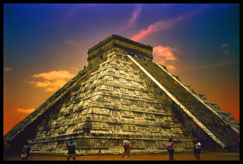 The market
This is one of the best examples of Hofgallerien in Chichen Itza, developed in the years between 900-1200 AD. Here are the architects of the Maya-Toltec style have made ??considerable progress by having built more intermediate levels and higher columns, as usual. Although the original meaning of the complex can not be determined with absolute certainty, is certain that it was directly connected to the forecourt, with which it is connected via a wide staircase. It has a wide front gallery with a total of three entrances to the area and a stairway access to the inside of the court. In the vicinity of this access is an altar with personifications. Around the courtyard are built around very high columns, which originally supported the ceiling, but over time collapsed and verfiehl.
Venus Platform
Venus platform is very similar to that which stands on the place of the pyramid of Kukulkan. On all four sides of a staircase leads up to Palttform, and is right next to the stairs and one snake's head forward. He represents Quetzalcoatl - Kukulkan as a morning star.The Plattforrm was originally painted in color, in green, red, ocher, blue and black. In the Osttreppe an offering of a man was found.
Jaguar Temple
The Jaguar Temple is located on the right before the inlet to the ball court. Today, unfortunately, the staircase is blocked, the left leads up around the temple.At the foot - on the side of the square with the pyramid of Kukulkan - is the lower part of the Jaguar Temple. He shows very nice and well-preserved wall reliefs with hieroglyphics inside of the stem and on the columns.
Observatory
This building (El Caracol) is also known as an observatory, due to its shape and because of some possible astral associations. Astronomical conditions in relation to the planet Venus as well as in relation to the sun during the day and night the same (equinox) have a unique connection to the three windows at the top of the observatory. The Mayans were so right in the stargazing that they, for example, over 59 years, the Great Conjunction to the day could be predicted.The name Caracol (snail) is due to the spiral staircase that leads to the top of the building.One study, the observatory by the Carnegie Institute from 1925-31, where they found a series of 6 over the other built constructions. It is estimated that the construction from the period between the end of the Classical and early Post Classic (850-1000 AD). Is.
Graves platform
This platform may have been used for burials, which gave her the name. The archaeologist Edward H. Thompson, who led the excavations here in 1899, found in each of the two grave chambers Sklette. Recent studies have nevertheless considered that the Sklette came into it here at later times, the building then had a different purpose. Noticeable in the architecture are the pillars that stand out from the platform and probably a thought over the centuries, not durable roof.
The Red House
The name of this building (it is also called Chichanchoob) comes from the red-painted fragments that were found inside. It stands on an unusually high platform, is a hall and three chambers. In the main chamber are sculptured hieroglyphics.The facade is smooth, and the two roof ridges suggest Puuc style, the building can be dated to the late classical period.It is because of the nearby ball court assumes that the building had either a religious or public purpose.
Chichen Itza was declared in 1988 a World Heritage Site, and there are probably more than any other Mayan site, which was restored as well, and from which it is so much to see for the visitor is like this. That will however accept a variety of tourists, so that it can clock from 10 am to be very full.
Among the major tourist attractions, among many other va the great pyramid of Kukulkan, the Observatory, the Juego de Pelota, the Temple of the Warriors, the Convento de las Monjas and El Grupo de las Mil Columns.
Probably the most famous building Chichen Itza's is the 24 meter high pyramid of Kukulkan. Two of the four sites were restored (west and north side). It forms a mixture of Mayan and Toltekenkultur and provides a calendar with four staircases, each with 91 steps dar. 4 x 91 steps is 364 steps, plus a final stage (platform) is 365 steps. This corresponds to the days of the year. This is not the only evidence that this building was dedicated to astrological purposes:
On the right side of the north staircase, you can enter the interior of the pyramid and climb a narrow staircase to the top. Caution, the stairs are due to lack of ventilation and the many tourists very slippery, also the air is very stuffy. Once at the top, the visitor a sealed chamber that is illuminated and houses two statues. One of them symbolizes the God Chaac-mole in its typical of this region, semi-reclining position with a sacrificial plate on the abdomen (similar to the Temple of the Warriors).
Ball Court
Overall, in Chichen Itza found 9 ball courts. Of the well over 520 BallschpielplAtzen found on the Yucatan is this ball court (juego de pelota) the largest and most important dar.
It is located about 100 meters northwest of the pyramid of Kukulkan. The dimensions of the playing field be 168 x 38 feet, separated by 8 feet high walls on the sides, including the intended for the audience were.On each page is located at a height of about 7 meters depending on a snake-decorated ring through which the ball had to be beaten. This consisted of rubber and weighed as much as getting our medicine balls. You still puzzled as to whether the ball was inside a skull.The motives of the two rings (cross-basket) to draw conclusions on the game (paddle) to, after which it is probable that the captain of the losing team was sacrificed (the captain of the winning team holding a knife in one hand and the bleeding head of the victim in the other hand). Each team had 5-7 players, sometimes also unevenly distributed. In addition, the players had protectors on arms and legs, because the ball could be played with this and do not touch the ground.
Particular attention should, however, the acoustics of the ball court to be paid. Today it is no longer to enjoy to the fullest, because the interesting sites are blocked. If you imagine each head into the central building, one can talk in peace, although the other nearly 200 meters wide (others have this conversation with barely). But what still works is that one anywhere on the court clapping their hands and get a fireworks display of echo. If one considers that the Maya architects have not left to chance, so this is an impressive achievement.
Cenote
About 400 meters straight to the north of the pyramid of Kukulkan is the impressive Cenote Sagrado (holy well). From him Chichen Itza takes its name (well of the Itza). The cenote was covered initially safe, but collapsed after some time. It measures today approximately 55 feet in diameter and about 50 meters in depth (up to the surface it is only about 20 meters). The green color of the water produced due to the many algae.
We now know that in this cenote many sacrifices were made. The ArchA?loge Edward H. Thompson was the first to examine the cenote, and found many offerings, including gold, jade and various ceramics. Also up to 50 Sklette were found here. Thomson, who was also consul did, but things out of the country, so he was eventually expelled from the country. By 1960, the most important investigations were made to the cenote, which brought many thousands of artefacts evident. The importance of this well exceeds that of any other in Yucatan.
Sculpted pillars
East side, building 3D7: These facades were originally part of standing in front of buildings. Here they were found and restored in parts to get an idea of the former extent to provide the decoration.
Temple of the Warriors
The Temple of the Warriors (Templo de los Guerreros) is northeast of the pyramid of Kukulkan, at the northern end of the group of the 1,000 pillars. It is one of the finest examples of Maya-Toltec architecture. He was inspired by the morning star temple of Tula, where he designed much more impressive and stylish than in Tula.A staircase gets you (now unfortunately closed to tourists) on the upper deck to look at the God Chaac-mole in a semi-recumbent attitude. However, this figure was the name given by French archaeologists Le Plongeon mistake, because it is not this is the rain god Chaac.
At the underen walls of the pyramid and some columns are decorated with relief masks that represent the Warriors and Eagles, as they devour human hearts. The entrance of the temple is located on the upper platform, and it is marked by two snake pillar. They come from the Toltec style. The trunk of the rain god nose Chaac however, as they are in the temple walls come from, the Mayan influence.
The north side of the warrior temple has a staircase leading into the interior of the temple. However, it is blocked, and so can not recognize the now barely recognizable murals.
Steam Bath
This created between 900-1200 AD, is one of the few buildings in Chichen Itza, there is no doubt about its original meaning. Of the three areas, the following two are described: the first is a kind of waiting room, is the second it is the actual steam room. Here the hot stones were splashed with water so as to generate the steam. The baths were used for cleaning during religious occasions, but also to health as one of the oldest traditions of the people in Latin America.
Northeastern colonnade This building was originally part of the whole colonnade. Striking are the pillars that had supported the roof and an altar, decorated with ritual scenes. The plates above and in front of the altar show richly decorated people. A stone bench encircles the building from the inside. Side of the northern end is a floor that has likely served as a water supply, as a kind of Canal to the place of a Thousand Columns. Its facade was originally with masks, snakes, and mythical figures decorated
Chichen Itza
This is one of the best examples of Hofgallerien in Chichen Itza, developed in the years between 900-1200 AD. Here are the architects of the Maya-Toltec style have made ??considerable progress by having built more intermediate levels and higher columns, as usual. Although the original meaning of the complex can not be determined with absolute certainty, is certain that it was directly connected to the forecourt, with which it is connected via a wide staircase. It has a wide front gallery with a total of three entrances to the area and a stairway access to the inside of the court. In the vicinity of this access is an altar with personifications. Around the courtyard are built around very high columns, which originally supported the ceiling, but over time collapsed and verfiehl.
Venus Platform
Venus platform is very similar to that which stands on the place of the pyramid of Kukulkan. On all four sides of a staircase leads up to Palttform, and is right next to the stairs and one snake's head forward. He represents Quetzalcoatl - Kukulkan as a morning star.The Plattforrm was originally painted in color, in green, red, ocher, blue and black. In the Osttreppe an offering of a man was found.
Jaguar Temple
The Jaguar Temple is located on the right before the inlet to the ball court. Today, unfortunately, the staircase is blocked, the left leads up around the temple.At the foot - on the side of the square with the pyramid of Kukulkan - is the lower part of the Jaguar Temple. He shows very nice and well-preserved wall reliefs with hieroglyphics inside of the stem and on the columns.
Observatory
This building (El Caracol) is also known as an observatory, due to its shape and because of some possible astral associations. Astronomical conditions in relation to the planet Venus as well as in relation to the sun during the day and night the same (equinox) have a unique connection to the three windows at the top of the observatory. The Mayans were so right in the stargazing that they, for example, over 59 years, the Great Conjunction to the day could be predicted.The name Caracol (snail) is due to the spiral staircase that leads to the top of the building.One study, the observatory by the Carnegie Institute from 1925-31, where they found a series of 6 over the other built constructions. It is estimated that the construction from the period between the end of the Classical and early Post Classic (850-1000 AD). Is.
Graves platform
This platform may have been used for burials, which gave her the name. The archaeologist Edward H. Thompson, who led the excavations here in 1899, found in each of the two grave chambers Sklette. Recent studies have nevertheless considered that the Sklette came into it here at later times, the building then had a different purpose. Noticeable in the architecture are the pillars that stand out from the platform and probably a thought over the centuries, not durable roof.
The Red House
The name of this building (it is also called Chichanchoob) comes from the red-painted fragments that were found inside. It stands on an unusually high platform, is a hall and three chambers. In the main chamber are sculptured hieroglyphics.The facade is smooth, and the two roof ridges suggest Puuc style, the building can be dated to the late classical period.It is because of the nearby ball court assumes that the building had either a religious or public purpose.
Thursday, March 24, 2011
Uluru-Ayers Rock in Australia
Uluru (translated: "shady place") is located in Australia and is probably better known by the names that gave him his first white explorers: Ayers Rock. He is in the thick in the Red Centre, right in the middle of the vast red desert in the center of the continent.
Apart from its sublime beauty and variety of colors, which he runs through the course of each day, is above all a most interesting to him:
Uluru from the air is a huge monolith. Not to say: almost the largest monolith in the world. So, to be exact, the second largest contiguous stone. For a long time he was held even for the largest but it turned out, that is Mt Augustus a little giant - where this is? - Well, certainly in Western Australia ...
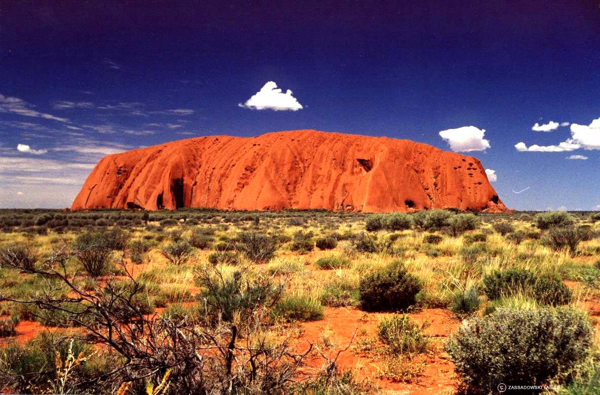 Whatever the case - he's definitely the most fascinating!
Uluru is about 4 ½ miles long, wide, 2 ½ km, and 348.7 meters high - and this is only its smallest part, because most of it is still buried.
Actually he is a huge piece of sedimentary rock (like sandstone).
Before about 600 million years ago was a huge mountain range removed slowly and was deposited in a layer.
Last ray of sun on the horizon, and a huge piece of this plateau is broke then just turned off so and also by about 75 degrees. We see today, the deposit layers of different ages - so, yes, strictly speaking, actually its height - ah - depth?
He is not alone the way around there. Just under 60km our suite are the Olgas, a piece from another layer that shows signs of erosion even clearer than her famous brother.
Aerial view of Ayers Rock, Uluru is yes NTGenaugenommen of relatively coarse sand (as opposed to the fine sand stone that is known to us). And the sand is more gray. As the rock but - like the whole Red Center actually - has a very high iron component, he 'rusty' or less on its surface.
It also overcomes the huge plane in which he is quite heavy, which means that it is also quite covered with red dust
Uluru - The Sanctuary
Uluru is sacred to the Aborigines, especially the Anangu, as the local tribe was called. Therefore, it is really - except for ceremonial occasions - forbidden to climb it.
Nevertheless, scrambling every day hundreds of tourists to the sanctuary, and as judge, most can not, what the thing is it actually, and most importantly, how steep and hot it is up there from 10 clock in the morning, it cost the Australian government a lot of money , all the crazies who have already received again at noon, halfway sunstroke to rescue by helicopter.
The Climb - where every day hundreds of Turi, the sanctuary was there extra climb a small hospital set up its own helicopter, which devours huge sums every year, just to save crazed tourists who think they would have to climb file.
Incidentally, the Yulara Tourist Resort is the third largest city in the Northern Territory. This shows how much seen 'The Rock' as the locals call it in, is actually ...
Uluru in the rain, the Aborigines have become accustomed - what should they do?
They call the crazies just "the ants".
For just as they look when they rise every morning at the shallowest point of Uluru, shimmy to a long railing made of steel rope to the top (because the mountain is also in this, his g & uumlnstigsten body damn steep) - in a non-interminable chain - just like a giant ant trail.
Rock paintings at Uluru along the Uluru are many holy places. Including some which actually only men, and others, to which only women are allowed. These can then be brought to manhood and Fraubarkeitsritualen.
Others are general holy places, where certain ceremonies are held. Often there are also ancient wall paintings.
And to all the places there are of course a different story from the Dreamtime.
The Uluru history
Uluru was created during the creation period of two boys who were playing in the mud after rain.
After they had finished their game, they migrated south to Wiputa, on the north side of Musgrave mountain range, where the euro (hill kangaroo) hunted and cooked.
Mt.Conner approximately 200km from Uluru then the boy turned back north towards Atila (Mt Conner).
A few miles southwest of the mountain, threw in Anari, a boy his tjuni (a wooden leg) for a wallaby (small kangaroo). But the leg touched the ground and created a fresh water source.
This boy did not say where the source was and the other boy nearly died of thirst.
Fighting each other, the two boys came to the table similar plateau of Mount Conner, to see on their bodies in the form of large rocks even today.
Apart from its sublime beauty and variety of colors, which he runs through the course of each day, is above all a most interesting to him:
Uluru from the air is a huge monolith. Not to say: almost the largest monolith in the world. So, to be exact, the second largest contiguous stone. For a long time he was held even for the largest but it turned out, that is Mt Augustus a little giant - where this is? - Well, certainly in Western Australia ...
Uluru is about 4 ½ miles long, wide, 2 ½ km, and 348.7 meters high - and this is only its smallest part, because most of it is still buried.
Actually he is a huge piece of sedimentary rock (like sandstone).
Before about 600 million years ago was a huge mountain range removed slowly and was deposited in a layer.
Last ray of sun on the horizon, and a huge piece of this plateau is broke then just turned off so and also by about 75 degrees. We see today, the deposit layers of different ages - so, yes, strictly speaking, actually its height - ah - depth?
He is not alone the way around there. Just under 60km our suite are the Olgas, a piece from another layer that shows signs of erosion even clearer than her famous brother.
Aerial view of Ayers Rock, Uluru is yes NTGenaugenommen of relatively coarse sand (as opposed to the fine sand stone that is known to us). And the sand is more gray. As the rock but - like the whole Red Center actually - has a very high iron component, he 'rusty' or less on its surface.
It also overcomes the huge plane in which he is quite heavy, which means that it is also quite covered with red dust
Uluru - The Sanctuary
Uluru is sacred to the Aborigines, especially the Anangu, as the local tribe was called. Therefore, it is really - except for ceremonial occasions - forbidden to climb it.
Nevertheless, scrambling every day hundreds of tourists to the sanctuary, and as judge, most can not, what the thing is it actually, and most importantly, how steep and hot it is up there from 10 clock in the morning, it cost the Australian government a lot of money , all the crazies who have already received again at noon, halfway sunstroke to rescue by helicopter.
The Climb - where every day hundreds of Turi, the sanctuary was there extra climb a small hospital set up its own helicopter, which devours huge sums every year, just to save crazed tourists who think they would have to climb file.
Incidentally, the Yulara Tourist Resort is the third largest city in the Northern Territory. This shows how much seen 'The Rock' as the locals call it in, is actually ...
Uluru in the rain, the Aborigines have become accustomed - what should they do?
They call the crazies just "the ants".
For just as they look when they rise every morning at the shallowest point of Uluru, shimmy to a long railing made of steel rope to the top (because the mountain is also in this, his g & uumlnstigsten body damn steep) - in a non-interminable chain - just like a giant ant trail.
Rock paintings at Uluru along the Uluru are many holy places. Including some which actually only men, and others, to which only women are allowed. These can then be brought to manhood and Fraubarkeitsritualen.
Others are general holy places, where certain ceremonies are held. Often there are also ancient wall paintings.
And to all the places there are of course a different story from the Dreamtime.
The Uluru history
Uluru was created during the creation period of two boys who were playing in the mud after rain.
After they had finished their game, they migrated south to Wiputa, on the north side of Musgrave mountain range, where the euro (hill kangaroo) hunted and cooked.
Mt.Conner approximately 200km from Uluru then the boy turned back north towards Atila (Mt Conner).
A few miles southwest of the mountain, threw in Anari, a boy his tjuni (a wooden leg) for a wallaby (small kangaroo). But the leg touched the ground and created a fresh water source.
This boy did not say where the source was and the other boy nearly died of thirst.
Fighting each other, the two boys came to the table similar plateau of Mount Conner, to see on their bodies in the form of large rocks even today.
Canadian Rockies:Vancouver and the Rocky Mountains
Starting point of this impressive motorcycle trip through the Canadian Rockies, Seattle USA. The states of Montana and Idaho offer us a clear path to the border with Canada, where you can enchant your two wheels in combination with the many mountain passes and even quickly bring in the holidays Heaven. Charming villages, lakes, forests and endless, meandering lines alternate.
This 16-day organized tour is inclusive of transfers, all hotel accommodation for accommodation in double rooms, bike rentals include insurance, unlimited mileage, professional tour guide and escort with spare motorcycle, which also has space for luggage.
Day 1 Arrive Seattle
Flight to Seattle. Upon arrival, transfer to the hotel. We are short on fresh and go to the hotel bar where we learn to know the pleasure of a Drink's Fruit guide. He holds a short briefing at the start of the tour.
Seattle Day 2 - Winthrop (240 miles)
The machines are attracting front of the hotel this morning and now can really start our journey. The holiday feeling intoxicated us when we drive through the Mount Baker National Forest and see the Cascade Range with the highest volcano. Today's destination is the 'Western' City of Winthrop!
Day 3 Winthrop - Colville (160 miles)
We drive through the Colville Indian Reservation and Forest in Washington State in the extreme north-western United States. With the ferry we cross the Columbia River and tours further into the countryside to our hotel in Colville.
Day 4 Colville - Sandy Point (115 miles)
Along the Pend Oreille! River, we cruise up to Idaho today. They come completely to rest on the lonely roads through the Flathead Indian Reservation, home of three tribes: the "Bitterroot Salish," the "Kootenai" and the "Pend d'Oreilles lived 'which of the buffalo hunting and salmon fishing.
Day 5 Sand Point - Kalispell (175 miles)
Enjoy today, the beautiful skyline along the Lake, making it one of the deepest lakes in the United States. Many fish species live here, especially the rainbow trout feels at home here.
Day 6 Kalispell - Fernie (230 miles)
Early! About the Logan Pass, we reach Glacier National Park with its many passes and many small lakes. We leave this Urstaat Montana! And cross the border. We are in Canada! We will sleep in Fernie, a nice resort.
Fernie Day 7 - Banff (180 miles)
We are now in the Canadian State of British Columbia and buzz through the Kootenay National Park Nature here is overwhelming, the lakes, sometimes as blue as the sky, and days when deep jade green. It invites too many stops! Our goal today is the popular ski resort Banff, surrounded by many glaciers.
Dag 8 Banff - Jasper (175 miles)
Today again to forget a day he never to: the Columbia Icefield Highway through the Canadian Rockies. This road is a pleasant little traffic. On the way we see spectacular snowy mountain peaks, the famous Lake Louise, forests, and perhaps grizzly! We make quarters in Jasper, a quiet and charming village with lots of Indian culture.
Jasper Day 9 - 100 Miles House (265 miles)
We leave today to tour the mountains and a good bit through the woods. The many so-called log-houses, fall upon '. The town of 100 Miles House is the home of the wooden house zeal.
Day 10 100 Miles House - Vancouver (285 miles)
Through small towns and villages we reach Whistler, the famous winter sports resort. The town owes its name to the wind that blows on stormy days around the peak. This environment is really heavenly, if you are a dreamer curve. After the break we reach the Lions Gate Bridge, which leads us to Vancouver. In the evening we do the Gaslight District unsafe by our visit to the pub.
Day 11 Vancouver - Tofino (165 miles)
From the ferry, which brings us to Nanaimo on Vancouver Iceland, we see great fjords, islands and sometimes even whales, orcas and seals. Keep your photo and film cameras ready!
Day 12 Tofino - Port Angelis (205 miles)
We travel today to the capital of Iceland Vancouver, Victoria. There we have a lot of time to visit the pleasant town with their English influences. At sunset, you go on a ferry across the Strait of Juan de Fuca. We are back in the U.S..
Day 13 Port Angelis - Seattle (170 miles)
With the many serpentine roads that we ride today, opposition neck is useful. From time to time, we know not where to look, there are so many beautiful things here. On one side great views of the Olympic National Park and the other side of the Hood Canal Dabob Bay. We drive on Highway 1, the Pacific Coast Highway begins, here and leads to the Mexican border.
Seattle day 14 (day off)
To conclude this journey we will enjoy a free day in Seattle, also Emerald City 'called. The city owes its name to the many evergreen forests. Seattle is also famous for its coffee culture: it is in fact the home of the famous coffee company Starbucks. Visit, for example, the Pike Place Market or the Seattle Aquarium. Even a visit to the Magic Space Needle is worth it.
Day 15 Seattle - Europe
Transfer by hotel shuttle to the airport. But maybe you want to still not home! to extend your stay is entirely possible. Give us a call and we can book yours! Further requests.
Day 16 Arrival Europe
Wednesday, March 23, 2011
The Taj Mahal History and general information
The Taj Mahal is considered the most beautiful creation of Muslim architecture in India. The great mausoleum was the fifth Mughal emperor Shah Jahan in memory of his beloved wife, the Persian princess Arjuman Bano Begum, who also was called Mumtaz Mahal built. She had a great influence on his life and died in his politics and in 1631 at the birth of the fourteenth child at the age of 39. On her deathbed she wished with her husband, a tomb, as the world has seen before ever.

In response, the Mughal emperor built the Taj Mahal, which has sprung out of a fairytale or a dream scheint.Der correct name of the Taj Mahal not delivered. Translated, the name Crown Palace or crown of the palace and it is assumed that as the princess was also called. The Taj was built in time from 1631 to about 1648th Although the exact year of completion is not known to show different sources earlier years, 2004 in Agra has been officially carried out by the state government of Uttar Pradesh, the 350 year anniversary. Due to severe environmental pollution has started to slightly yellow color of the marble to accept what all since the beginning of 2007 car and bus traffic was banned within a radius of two kilometers. Tourists are now with horse-drawn carriages and battery-powered vehicles to the Taj Mahal gebracht.Etwa 20,000 workers were contracted to build the Taj Mahal, on a 100 x 100-foot platform that was like the Taj Mahal, built of marble. Even the Taj Mahal itself consists of a very large part of marble. The central dome is 57 meters high. The material for the construction was brought from all over Asia with over 1,000 elephants to Agra on the Yamuna River.
In the marble are 28 different types of precious and semi-precious stones such as jade, lapis lazuli, sapphires and diamonds, have been inserted, and almost every surface was decorated in some way. The Taj Mahal is completely surrounded by a wall and on the sides there is a mosque, a guesthouse, opposite the Taj Mahal, the entrance building. In front of the Taj Mahal is a large garden with a small lake in the broader, reflecting the white marble. The Taj Mahal is still a great symbol of love and passion.
Welcome to New York!
Well, that was now perhaps a little exaggerated. So that with the "Welcome". For in New York you can be - unfortunately - not even when you're sitting at home on the computer and have driven this website. Still, it is important to plan your vacation in New York. And for that, you've come to the right place!If you have landed on us, it's not far to the destination of your journey. We provide all the information you need for your trip preparation and also for staying in the city on the Hudson River. And not only extremely clear and current, but also completely in German. As much service should be!Therefore do directly go and start first with your imaginary journey through the streets of New York. Be inspired by us - but watch for itchy feet, we can not accept any liability!
Highlights
Start right here with your virtual tour of the city - some New York highlights we have collected directly to the home page for you.
Central Park
From the former treeless, rocky swampland Since we got together in 1853 in the course of the years, a natural oasis that generations of New Yorkers and visitors to the city serves as a retreat from the hustle and bustle of the metropolis point and as a source of inspiration. Several movie sequences (for example, "Harry Met Sally") were shot here, a number of scenes in literary masterpieces (such as "The Catcher in the Rye") will play right here.Over 333 hectares of parks and recreation areas are created. There is also a zoo, a carousel, a theater, lakes, a castle, gardens and fountains. Central Park, The Mall - New York City, the park can be explored on foot or by bicycle, a carriage ride through the park are very popular.Today more than 25 million annual visitors enjoy the vast green space with its 26 000 trees and 9,000 park benches.The original idea came from the then most important landscape artists of the United States, Andrew Jackson Downing. He was responding to the desire of the population according to a recreational area, since in the former New York hardly leisure and entertainment opportunities exist. In an article in the magazine could Horticulturist 1848 he brought impetus to deliberations in the direction of a large public park where you can ride go walking, rowing, playing baseball or cricket, it should also be playgrounds for the children.
Brooklyn Bridge
The Brooklyn Bridge is a small miracle of technology. It was completed in 1883 and was at that time the longest suspension bridge in the world. It connects Manhattan and Brooklyn.
It was designed by German engineer John A. Roebling (John Augustus Roebling). He had studied at the Royal Polytechnic in Berlin and emigrated in 1831 in the USA. In 1841 he founded the first wire rope factory in America. From this point took his idea to build the longest and highest suspension bridge in the world, figure. 16 years, however, should pass before his plans were approved.
Due to an accident during construction, he died suddenly and did not live to complete. His son Washington took over the management of construction and put a caisson technique he had studied with his wife Emily. Here boxes were established as foundations under water. Compressed air prevented the ingress of water. Working conditions were horrible and many workers suffering from a strange disease. Today we know that this is the caisson that occurs when people leave hyperbaric chambers too fast. Roebling also fell ill it was suffering from severe pain and was paralyzed. He did not stop the construction, however, watching the progress from a wheelchair.
Emily Roebling took over the management of the gigantic construction site. They negotiated, the quality requirements set by the Roebling and turned away numerous intrigues.
Even in today's world, this achievement would still highly significant, in the late 19th Century it was almost unbelievable for a woman.
On 24 May 1883 opened the giant bridge with a huge feast.
Also today is a walk across the Brooklyn Bridge impressive and an integral part of his New York stay. On the elevated walkway to cross the East River and admire the impressive skyline of Manhattan. Almost directly under the bridge, the River Cafe is in Brooklyn noble with enchanting views. The sight of the Brooklyn Bridge is spectacular by day, at sunset and at night.
Statue of Liberty
The Statue of Liberty is a symbol of the United States become a country of immigration. At its base since 1903, the now famous lines from Emma Lazarus are attached: "Send me your tired, your poor, your geknechtetenn masses yearning to breathe free ..."
France's government had given the United States, this monument to the 100-year anniversary - the unveiling took place, however until ten years later, when they could only muster the funds for the base construction.
Gustave Eiffel, who later became the designer of the equally famous Eiffel Tower in Paris, developed the framework, standing with the aid of "Lady Liberty" the often violent storms in the New York Bay bi sheute held. In 1886 the memorial was finally unveiled.
Since 3 August 2004, the Statue of Liberty after extensive renovation to visit again. About $ 100 million cost of the "fun". The vast majority was collected from the former Chrysler chief Lee Iacocca.
Visitors can now also have the option, the Statue of Liberty Museum to visit and, separated by a glass wall to take a look into the interior of the figure. Especially recommended: the breathtaking panoramic view of education and the viewing platform on the sixteenth floor. Only the rise in the crown and the torch of the Statue of Liberty remains closed.
During the renovation, a new ticketing system was introduced by members of the long queues now the past. The security arrangements have been extended and improved the emergency exits. The statue was after 11 September has been closed to the public. In December 2001, the sightseeing tours were taken to Liberty Iceland again.
How to get to Liberty Iceland
The ferry will take you to Liberty Iceland. Loosen the best one spare ticket (adults $ 12, seniors 62 + $ 10, children 4-12 Jhren $ 5), which saves you some erhelblichen delays when boarding the ferry. With this ticket you get priced out without the Monument Pass, which you have access to the base of the Statue of Liberty and the observation deck.
The ferry from Battery Park, the extensive security checks begin at 9:00 clock. Before entering the statue, there are other controls.The ferry investors are respectively located at Battery Park (New York City) and Liberty State Park (Jersey City, New Jersey).Battery Park is located at the southern tip of Manhattan. Small Tip: How to use public transport, as the parking lots there are very limited. By phone you can get information about departure times of ferries at Tel 001-877-5239849.Of course, you can visit Liberty Iceland without a reservation, but you will not be admitted without reservation to the statue.
Attractions
Many people are the main attractions of the city already familiar - even if they themselves were not even in New York. The landmarks and attractions, the Statue of Liberty, Times Square, Broadway or the Brooklyn Bridge are the world almost by everyone. Countless Hollywood films and popular TV series (like "Sex and the City"), who play in New York, have greatly contributed to that reputation.
There are also museums of world renown, the landmark architecture and New York's Islands - New York City offers an incredible range of fascinating to and views. We present the following pages the major attractions of the city.
New York for first time visitors ...
Visitors who travel to New York for the first time can, of course not all at once and visit companies. One should also not try, but make individual choices. Here are the main attractions are combined that one must-see.
We recommend you order the tickets to New York's top attractions before you leave in our online ticket shop! To save time on site at the orientation and can plan your spending better.
1. Day
* A sightseeing tour with a double-decker bus is a good start to get something to give orientation. In NY city sights, you can get off at specific sites and take a later bus to continue the tour. Especially popular with German visitors sprachuígen is the 72-hour ticket "All Around Town Plus", where all the hop-on, can use hop-off tours and get additional benefit from a German-speaking city tour.
* Visit the Statue of Liberty directly or look at the statue from the water on. The impressive skyline from this perspective will remain unforgettable in your memory. The Immigration Museum Ellis Iceland near the Statue of Liberty shows how the experiences of immigrants, the ancestors of nearly a quarter of the current U.S. population.
* Toll is also a helicopter flight where you can enjoy the beautiful skyline from the air. To get in the truest sense of the word an excellent overview.
* Stay in downtown, explore the South Street Seaport with its many restaurants and shops on the shore and a beautiful view of the Brooklyn Bridge.
* In the evening you could walk in SoHo with the stylish art galleries, boutiques and bistros in the famous cast-iron architecture to explore. Or experience the student and artist's Greenwich Village and the Washington Arch of Stanford White on the side of Fifth Avenue in Washington Square Park drinking an espresso in a coffee shop on Bleecker Street or dine in one of Thai, Indian, French, Polish or Japanese restaurants.
2. Day
* Spend the morning in Midtown East and visit the Chrysler Building in the Art Deco style and the United Nations. Wednesdays are even free tours of the recently restored Grand Central Terminal offered. There you can splendid food in a restaurant under the starry vault at noon.
* In the afternoon you can stroll to Rockefeller Center (Top of the Rock). The Channel Gardens, statue of Prometheus and the Lower Plaza are to be admired here. In winter, the giant Christmas tree lit up and many people skate. Is it warmer in the spring, the ice rink into an outdoor restaurant. Walk up to Fifth Avenue, at St. Patrick's Cathedral, past the Trump Tower and several shops in the upmarket or westwards to the Radio City Music Hall.
* In the evening you can visit a memorable performance at Lincoln Center. The following performances: Metropolitan Opera, New York Philharmonic, Jazz at Lincoln Center, New York City Opera and New York City Ballet.
3. Day
* On the third day, you can take a bike ride in Central Park, which is offered by Central Park Bicycle Tours, or just go walking. At the 82nd Street and Park, the Metropolitan Museum of Art is located. Among the 150 museums in New York City is the Met with exhibits from 5000 years ago, the largest museum in the western hemisphere.
* Then take the bus from Fifth Avenue downtown to 59th Street. On the way you see great buildings, most of which are residential. In the Fifth can buy excellent, as long as it allows the credit card. To the west of Times Square, the revitalization of this area is clearly visible. At the TKTS booth will be discounted tickets for Broadway shows, sold, or are listed on the same evening at Broadway and 47th Street.
* Before the show begins, you still have time for a ride to 86th Floor of the Empire State Building. In the late afternoon you can one hand the city by day and watch the other in the twilight with millions of lights. Many restaurants offer the Theater District called pre-theater dinner specials that are cheaper before the performance.
Tuesday, March 22, 2011
Sydney Opera House
Sydney Opera House boasted its iconic bridge. Painted a gloomy gray, he seemed to Calvinist conscience, looms over the town, which was conceived as a gulag of King George, and still can not free itself from the strong influence of the small island at the other end of the world. One look at our bridge enough to watch a second time did not want to. The construction of this solid structure was almost ruined the British firm of Dorman, Long. Granite piers, enlarged copy of a Cenotaph in Whitehall, in fact, nothing does not support, but their construction has helped Yorkshire Middlesbrough survive depression. But even decorated with Olympic rings and enormous Australian flag, the Sydney Bridge is now nothing more than a proscenium, as the views of tourists irresistibly attracts a wonderful silhouette of the Opera, which seemed to hover over the blue waters of the harbor. This generation of daring architectural fantasy easily outshines most giant steel arch in the world.

Some believe the Opera House a magnificent specimen of "frozen music," spoken of by Goethe. Others see it thrown out on the land the white whale; galleon, sailing to the magical land of elves and nine ears, listening to the angelic singing and nine nuns playing football ... "Claws, chop off a huge dog-albino" - so once put the Sydney journalist Ron Saw. "Like something crawled out of the bay to the land and died, - taunted a hostile policy and added: - pies in this thing are not going to sell." Like all true masterpieces, the Opera House is unique and is similar only to itself. Of course, I am only talking about his appearance. Interior, which is rarely photographed, born under the influence of diverse ideas 60's and reminds hall to play bingo, even in the same Middlesbrough. In a sense, the Opera House did not justify its name - most of the opera is set not. Small hall, designed for chamber music performances, almost entirely black. Add back a brilliant ball and get the usual suburban disco. Why did it happen? The fact that the building was designed by one man, a Danish architect Jorn Uttson, and its interior - complicated commission, which the Australian critic Philip Drew calls "a bunch of nothingness." It is a sad story but it helps to understand why almost all modern architectural buildings so ugly.
As he Sydney Opera House was coined by the British. In 1945 in Australia, Sir Eugene Goossens arrived, a violinist and composer, who was invited by the Australian Committee for Television and Radio (while it was headed by another Refined Briton, Sir Charles Moses) as a conductor to record the concert series. Goossens discovered by local residents, "an unusually strong interest" to the musical art, but to satisfy it was almost nowhere, except the Sydney Town Hall, on the architecture resembles a "wedding cake" in the spirit of the Second Empire, with bad acoustics and the audience of 2500 people. Like many other visitors, Goossens struck sidneytsev indifference to the magnificent panorama, against which the city spread, and their love for the hackneyed European ideas that have arisen in a very different historical and cultural context. This "cultural cringing" later reflected in the skirmish at the Opera House designed by foreigners.
Goossens, this lover of bohemian life and a tireless bon vivant, know what is missing: the palace to opera, ballet, theater and concerts - "Society must be aware of contemporary musical achievements." In the company of Kurt Langer, a city planner originally from Vienna, he was a true missionary zeal combed the city looking for a suitable location. They opted for a rocky promontory Bennelong Point near circular quay - a nodal point, where citizens transplanted from ferries to trains and buses. On this promontory, named in honor of the Australian aborigines, another first Sydney governor, stood Fort Macquarie - this monster, pozdneviktorianskaya fake antique. For its strong walls with loopholes and battlements turrets hidden modest facility - central tram depot. Short period of fascination with the criminal past of Sydney residents were still ahead. "And thank God - as noted by one visitor - otherwise they would be recorded in the monuments, even tram depot!" Goossens considered findings are "ideal". He dreamed about a huge audience hall at 3500-4000, in which all isstradavshiesya without music sidneytsy could finally quench your cultural thirst.
The first "conversion" began Mr. Ingem Ashuert, a former British colonel at the time professor of architecture at Sydney University. If he knew what a sense, it is likely in the Indian barracks than in opera houses, but once charmed ideas Goossens, became her loyal adept and tenacious defender. Ashuert Goossens introduced to John Joseph Cahill, a descendant of Irish immigrants, who soon was to become the Labour premier of New South Wales. Expert in backroom politics, dreams carry art to the masses, Cahill has provided a plan of aristocrats supported the Australian public - many to this day called the Opera House Taj Cahill. " He was attracted to the cause of yet another lover of the opera - Wall Haviland, head of Sydney Water Management. Things are moving.
May 17, 1955 the State Government gave permission to build the Opera House on Bennelong Point, under the condition that public funds are not needed. On the design of the building was declared an international competition. The following year, Cahill's office with great difficulty, managed to hold on to power for a second three-year term. Time is running out, but the sanctimonious, the provincial New South Wales is already preparing the fighters for the cultivation of Sydney's first retaliatory strike. Some unknown called Moses, and warned that the baggage Goossens, who had gone abroad to study opera houses, will be inspected at Sydney airport - then, in donarkoticheskuyu era, it was unheard of impudence. Moses did not disclose this to his friend, and on his return in suitcases were found Goossens attributes "Black Mass", including rubber masks, shaped genitals. It turned out that the musician sometimes whiled away the boring Sydney evening in the company of lovers of black magic, led by a certain Rosalyn (Rowe) Norton - a very famous person in the relevant circles. Goossens said that the ritual accessories (which today would not have received even a cursory glance at the annual ball of Sydney gay men and lesbians) were imposed on his blackmailers. His was fined one hundred pounds, he left the conductor of the new Sydney Symphony Orchestra and went back to England, where he died in misery and obscurity. So Opera has lost its first, most eloquent and influential advocate.
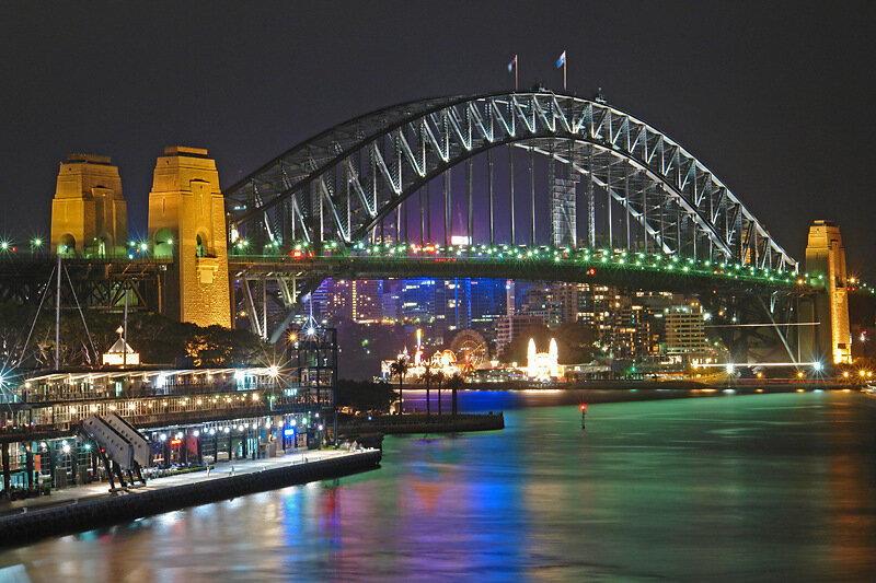 The Sydney Harbour Bridge is a steel through arch bridge across Sydney Harbour that carries rail, vehicular, bicycle and pedestrian traffic between the Sydney central business district (CBD) and the North Shore. The dramatic view of the bridge, the harbour, and the nearby Sydney Opera House is an iconic image of both Sydney and Australia. The bridge is locally nicknamed "The Coat Hanger" because of its arch-based design.
Some believe the Opera House a magnificent specimen of "frozen music," spoken of by Goethe. Others see it thrown out on the land the white whale; galleon, sailing to the magical land of elves and nine ears, listening to the angelic singing and nine nuns playing football ... "Claws, chop off a huge dog-albino" - so once put the Sydney journalist Ron Saw. "Like something crawled out of the bay to the land and died, - taunted a hostile policy and added: - pies in this thing are not going to sell." Like all true masterpieces, the Opera House is unique and is similar only to itself. Of course, I am only talking about his appearance. Interior, which is rarely photographed, born under the influence of diverse ideas 60's and reminds hall to play bingo, even in the same Middlesbrough. In a sense, the Opera House did not justify its name - most of the opera is set not. Small hall, designed for chamber music performances, almost entirely black. Add back a brilliant ball and get the usual suburban disco. Why did it happen? The fact that the building was designed by one man, a Danish architect Jorn Uttson, and its interior - complicated commission, which the Australian critic Philip Drew calls "a bunch of nothingness." It is a sad story but it helps to understand why almost all modern architectural buildings so ugly.
As he Sydney Opera House was coined by the British. In 1945 in Australia, Sir Eugene Goossens arrived, a violinist and composer, who was invited by the Australian Committee for Television and Radio (while it was headed by another Refined Briton, Sir Charles Moses) as a conductor to record the concert series. Goossens discovered by local residents, "an unusually strong interest" to the musical art, but to satisfy it was almost nowhere, except the Sydney Town Hall, on the architecture resembles a "wedding cake" in the spirit of the Second Empire, with bad acoustics and the audience of 2500 people. Like many other visitors, Goossens struck sidneytsev indifference to the magnificent panorama, against which the city spread, and their love for the hackneyed European ideas that have arisen in a very different historical and cultural context. This "cultural cringing" later reflected in the skirmish at the Opera House designed by foreigners.
Goossens, this lover of bohemian life and a tireless bon vivant, know what is missing: the palace to opera, ballet, theater and concerts - "Society must be aware of contemporary musical achievements." In the company of Kurt Langer, a city planner originally from Vienna, he was a true missionary zeal combed the city looking for a suitable location. They opted for a rocky promontory Bennelong Point near circular quay - a nodal point, where citizens transplanted from ferries to trains and buses. On this promontory, named in honor of the Australian aborigines, another first Sydney governor, stood Fort Macquarie - this monster, pozdneviktorianskaya fake antique. For its strong walls with loopholes and battlements turrets hidden modest facility - central tram depot. Short period of fascination with the criminal past of Sydney residents were still ahead. "And thank God - as noted by one visitor - otherwise they would be recorded in the monuments, even tram depot!" Goossens considered findings are "ideal". He dreamed about a huge audience hall at 3500-4000, in which all isstradavshiesya without music sidneytsy could finally quench your cultural thirst.
The first "conversion" began Mr. Ingem Ashuert, a former British colonel at the time professor of architecture at Sydney University. If he knew what a sense, it is likely in the Indian barracks than in opera houses, but once charmed ideas Goossens, became her loyal adept and tenacious defender. Ashuert Goossens introduced to John Joseph Cahill, a descendant of Irish immigrants, who soon was to become the Labour premier of New South Wales. Expert in backroom politics, dreams carry art to the masses, Cahill has provided a plan of aristocrats supported the Australian public - many to this day called the Opera House Taj Cahill. " He was attracted to the cause of yet another lover of the opera - Wall Haviland, head of Sydney Water Management. Things are moving.
May 17, 1955 the State Government gave permission to build the Opera House on Bennelong Point, under the condition that public funds are not needed. On the design of the building was declared an international competition. The following year, Cahill's office with great difficulty, managed to hold on to power for a second three-year term. Time is running out, but the sanctimonious, the provincial New South Wales is already preparing the fighters for the cultivation of Sydney's first retaliatory strike. Some unknown called Moses, and warned that the baggage Goossens, who had gone abroad to study opera houses, will be inspected at Sydney airport - then, in donarkoticheskuyu era, it was unheard of impudence. Moses did not disclose this to his friend, and on his return in suitcases were found Goossens attributes "Black Mass", including rubber masks, shaped genitals. It turned out that the musician sometimes whiled away the boring Sydney evening in the company of lovers of black magic, led by a certain Rosalyn (Rowe) Norton - a very famous person in the relevant circles. Goossens said that the ritual accessories (which today would not have received even a cursory glance at the annual ball of Sydney gay men and lesbians) were imposed on his blackmailers. His was fined one hundred pounds, he left the conductor of the new Sydney Symphony Orchestra and went back to England, where he died in misery and obscurity. So Opera has lost its first, most eloquent and influential advocate.
Subscribe to:
Posts (Atom)